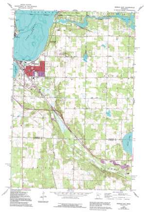
Bemidji East Topo Map Minnesota
To zoom in, hover over the map of Bemidji East
USGS Topo Quad 47094d7 - 1:24,000 scale
| Topo Map Name: | Bemidji East |
| USGS Topo Quad ID: | 47094d7 |
| Print Size: | ca. 21 1/4" wide x 27" high |
| Southeast Coordinates: | 47.375° N latitude / 94.75° W longitude |
| Map Center Coordinates: | 47.4375° N latitude / 94.8125° W longitude |
| U.S. State: | MN |
| Filename: | o47094d7.jpg |
| Download Map JPG Image: | Bemidji East topo map 1:24,000 scale |
| Map Type: | Topographic |
| Topo Series: | 7.5´ |
| Map Scale: | 1:24,000 |
| Source of Map Images: | United States Geological Survey (USGS) |
| Alternate Map Versions: |
Bemidji East MN 1968, updated 1970 Download PDF Buy paper map Bemidji East MN 1968, updated 1971 Download PDF Buy paper map Bemidji East MN 1968, updated 1995 Download PDF Buy paper map Bemidji East MN 2010 Download PDF Buy paper map Bemidji East MN 2013 Download PDF Buy paper map Bemidji East MN 2016 Download PDF Buy paper map |
1:24,000 Topo Quads surrounding Bemidji East
> Back to 47094a1 at 1:100,000 scale
> Back to 47094a1 at 1:250,000 scale
> Back to U.S. Topo Maps home
Bemidji East topo map: Gazetteer
Bemidji East: Airports
Chandler Airport elevation 421m 1381′Cloverleaf-East Bemidji Airport elevation 439m 1440′
Nary National-Shefland Field elevation 417m 1368′
Bemidji East: Beaches
Nymore Beach elevation 409m 1341′Bemidji East: Parks
Cameron Park elevation 410m 1345′Chet Anderson Stadium elevation 410m 1345′
Diamond Point Park elevation 409m 1341′
Nymore Park elevation 412m 1351′
Bemidji East: Populated Places
Norway Park elevation 414m 1358′Rosby elevation 412m 1351′
Southview Mobile Home Park elevation 415m 1361′
Bemidji East: Post Offices
Nymore Post Office (historical) elevation 411m 1348′Rosby Post Office (historical) elevation 440m 1443′
Bemidji East digital topo map on disk
Buy this Bemidji East topo map showing relief, roads, GPS coordinates and other geographical features, as a high-resolution digital map file on DVD:


