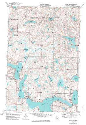
Skunk Lake Topo Map Minnesota
To zoom in, hover over the map of Skunk Lake
USGS Topo Quad 47095a1 - 1:24,000 scale
| Topo Map Name: | Skunk Lake |
| USGS Topo Quad ID: | 47095a1 |
| Print Size: | ca. 21 1/4" wide x 27" high |
| Southeast Coordinates: | 47° N latitude / 95° W longitude |
| Map Center Coordinates: | 47.0625° N latitude / 95.0625° W longitude |
| U.S. State: | MN |
| Filename: | p47095a1.jpg |
| Download Map JPG Image: | Skunk Lake topo map 1:24,000 scale |
| Map Type: | Orthophoto |
| Topo Series: | 7.5´ |
| Map Scale: | 1:24,000 |
| Source of Map Images: | United States Geological Survey (USGS) |
| Alternate Map Versions: |
Skunk Lake MN 1972, updated 1974 Download PDF Buy paper map Skunk Lake MN 2010 Download PDF Buy paper map Skunk Lake MN 2013 Download PDF Buy paper map Skunk Lake MN 2016 Download PDF Buy paper map |
1:24,000 Topo Quads surrounding Skunk Lake
> Back to 47095a1 at 1:100,000 scale
> Back to 47094a1 at 1:250,000 scale
> Back to U.S. Topo Maps home
Skunk Lake topo map: Gazetteer
Skunk Lake: Airports
Sky Manor Aero Estates elevation 465m 1525′Skunk Lake: Lakes
Blacksmith Lake elevation 455m 1492′Blue Lake elevation 440m 1443′
Churchill Lake elevation 450m 1476′
Coon Lake elevation 454m 1489′
Crooked Lake elevation 456m 1496′
Eagle Lake elevation 439m 1440′
Island Lake elevation 439m 1440′
Little Rice Lake elevation 443m 1453′
Lower Camel Lake elevation 451m 1479′
Lower Mud Lake elevation 442m 1450′
Many Arm Lake elevation 446m 1463′
Potato Lake elevation 439m 1440′
Rice Lake elevation 442m 1450′
Sawyer Lake elevation 448m 1469′
Skunk Lake elevation 451m 1479′
Stony Lake elevation 451m 1479′
Upper Camel Lake elevation 452m 1482′
Upper Mud Lake elevation 440m 1443′
Wabisish Lake elevation 468m 1535′
Skunk Lake: Streams
Hay Creek elevation 441m 1446′Skunk Lake digital topo map on disk
Buy this Skunk Lake topo map showing relief, roads, GPS coordinates and other geographical features, as a high-resolution digital map file on DVD:


