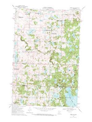
Ogema Ne Topo Map Minnesota
To zoom in, hover over the map of Ogema Ne
USGS Topo Quad 47095b7 - 1:24,000 scale
| Topo Map Name: | Ogema Ne |
| USGS Topo Quad ID: | 47095b7 |
| Print Size: | ca. 21 1/4" wide x 27" high |
| Southeast Coordinates: | 47.125° N latitude / 95.75° W longitude |
| Map Center Coordinates: | 47.1875° N latitude / 95.8125° W longitude |
| U.S. State: | MN |
| Filename: | o47095b7.jpg |
| Download Map JPG Image: | Ogema Ne topo map 1:24,000 scale |
| Map Type: | Topographic |
| Topo Series: | 7.5´ |
| Map Scale: | 1:24,000 |
| Source of Map Images: | United States Geological Survey (USGS) |
| Alternate Map Versions: |
Ogema NE MN 1969, updated 1971 Download PDF Buy paper map Ogema NE MN 2011 Download PDF Buy paper map Ogema NE MN 2013 Download PDF Buy paper map Ogema NE MN 2016 Download PDF Buy paper map |
1:24,000 Topo Quads surrounding Ogema Ne
> Back to 47095a1 at 1:100,000 scale
> Back to 47094a1 at 1:250,000 scale
> Back to U.S. Topo Maps home
Ogema Ne topo map: Gazetteer
Ogema Ne: Dams
White Earth Lake Dam elevation 442m 1450′Ogema Ne: Lakes
Blocknic Lake elevation 392m 1286′Burns Eighty Lake elevation 405m 1328′
Doucette Lake elevation 453m 1486′
Du Forte Lake elevation 425m 1394′
Espe Lake elevation 400m 1312′
George Lake elevation 459m 1505′
Hallot Lake elevation 444m 1456′
Horseshoe Lake elevation 441m 1446′
Jack Lake elevation 439m 1440′
Kersting Lake elevation 398m 1305′
Logger Lake elevation 441m 1446′
Nemec Lake elevation 450m 1476′
Paggen Lake elevation 428m 1404′
Pine Lake elevation 450m 1476′
Puson Lake elevation 451m 1479′
Quallen Lake elevation 446m 1463′
Sedivy Lake elevation 406m 1332′
Squareboat Lake elevation 447m 1466′
Squirrel Lake elevation 391m 1282′
White Earth Lake elevation 442m 1450′
Ogema Ne: Parks
Poodle Park elevation 447m 1466′Ogema Ne: Reservoirs
White Earth Lake elevation 442m 1450′Ogema Ne digital topo map on disk
Buy this Ogema Ne topo map showing relief, roads, GPS coordinates and other geographical features, as a high-resolution digital map file on DVD:


