Ulen Topo Map Minnesota
To zoom in, hover over the map of Ulen
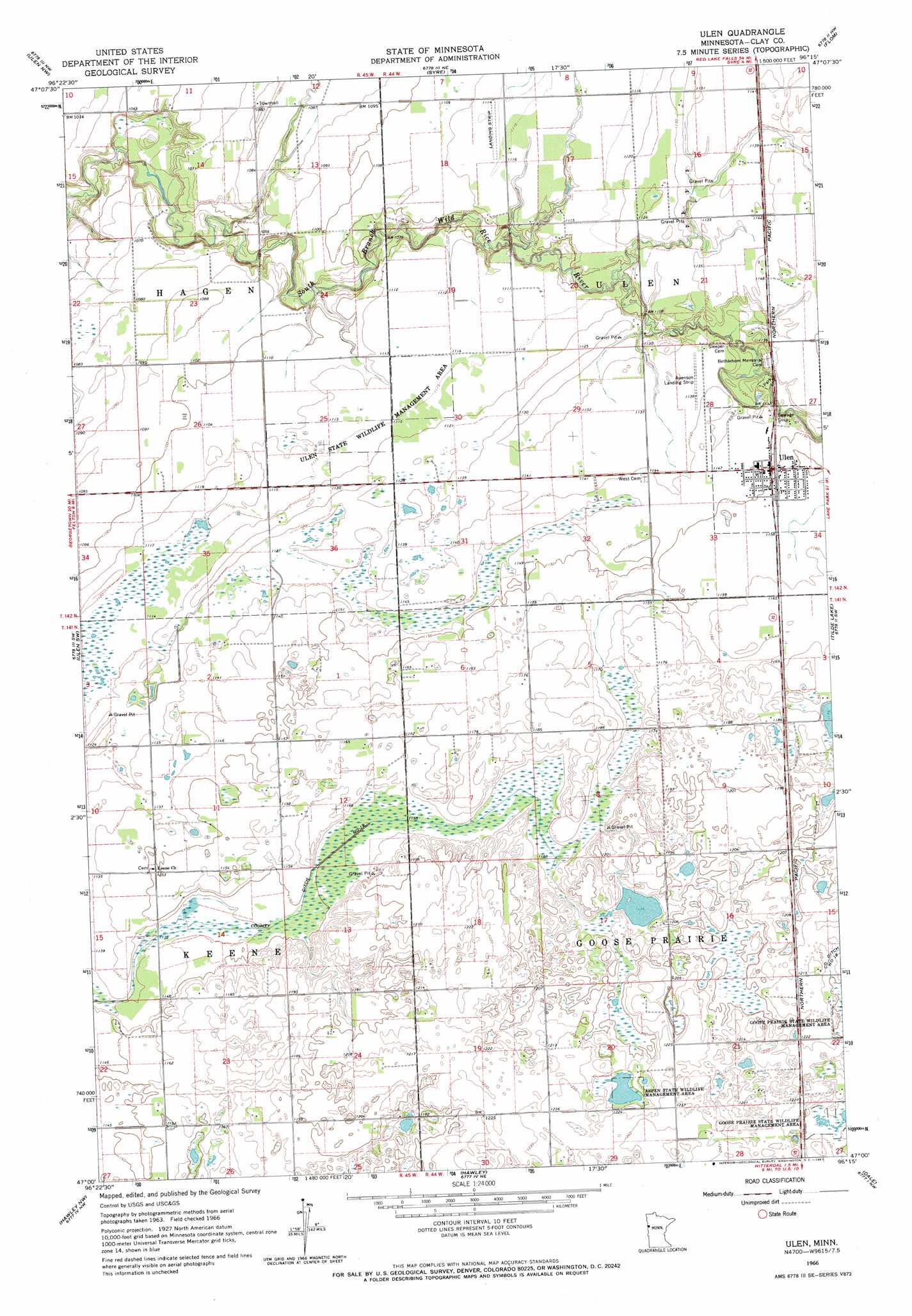
USGS Topo Quad 47096a3 - 1:24,000 scale
| Topo Map Name: | Ulen |
| USGS Topo Quad ID: | 47096a3 |
| Print Size: | ca. 21 1/4" wide x 27" high |
| Southeast Coordinates: | 47° N latitude / 96.25° W longitude |
| Map Center Coordinates: | 47.0625° N latitude / 96.3125° W longitude |
| U.S. State: | MN |
| Filename: | o47096a3.jpg |
| Download Map JPG Image: | Ulen topo map 1:24,000 scale |
| Map Type: | Topographic |
| Topo Series: | 7.5´ |
| Map Scale: | 1:24,000 |
| Source of Map Images: | United States Geological Survey (USGS) |
| Alternate Map Versions: |
Ulen MN 1966, updated 1967 Download PDF Buy paper map Ulen MN 2011 Download PDF Buy paper map Ulen MN 2013 Download PDF Buy paper map Ulen MN 2016 Download PDF Buy paper map |
1:24,000 Topo Quads surrounding Ulen
Ada |
Twin Valley Sw |
Twin Valley |
Waukon |
Faith |
Borup |
Ulen Nw |
Syre |
Flom |
Flom Ne |
Felton |
Ulen Sw |
Ulen |
Tilde Lake |
Flom Se |
Glyndon North |
Hawley Nw |
Hawley |
Dale |
Lake Park |
Glyndon South |
Downer |
Hawley Se |
Lake Park Sw |
Big Cormorant Lake |
> Back to 47096a1 at 1:100,000 scale
> Back to 47096a1 at 1:250,000 scale
> Back to U.S. Topo Maps home
Ulen topo map: Gazetteer
Ulen: Canals
County Ditch Number Ninteen elevation 352m 1154′Ulen: Parks
Aspen State Wildlife Management Area elevation 367m 1204′Ulen State Wildlife Management Area elevation 340m 1115′
Ulen: Populated Places
Ulen elevation 351m 1151′Ulen: Post Offices
Keene Post Office (historical) elevation 353m 1158′Ulen Post Office elevation 351m 1151′
Ulen digital topo map on disk
Buy this Ulen topo map showing relief, roads, GPS coordinates and other geographical features, as a high-resolution digital map file on DVD:
Eastern North Dakota & Eastern South Dakota
Buy digital topo maps: Eastern North Dakota & Eastern South Dakota