Flaming Topo Map Minnesota
To zoom in, hover over the map of Flaming
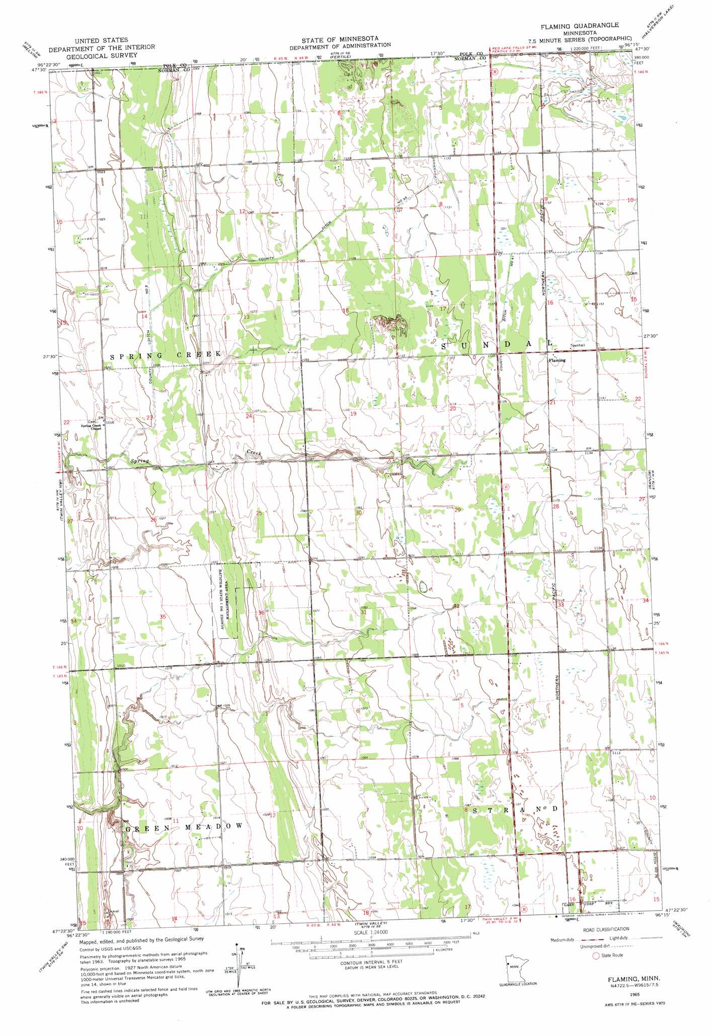
USGS Topo Quad 47096d3 - 1:24,000 scale
| Topo Map Name: | Flaming |
| USGS Topo Quad ID: | 47096d3 |
| Print Size: | ca. 21 1/4" wide x 27" high |
| Southeast Coordinates: | 47.375° N latitude / 96.25° W longitude |
| Map Center Coordinates: | 47.4375° N latitude / 96.3125° W longitude |
| U.S. State: | MN |
| Filename: | o47096d3.jpg |
| Download Map JPG Image: | Flaming topo map 1:24,000 scale |
| Map Type: | Topographic |
| Topo Series: | 7.5´ |
| Map Scale: | 1:24,000 |
| Source of Map Images: | United States Geological Survey (USGS) |
| Alternate Map Versions: |
Flaming MN 1965, updated 1967 Download PDF Buy paper map Flaming MN 2010 Download PDF Buy paper map Flaming MN 2013 Download PDF Buy paper map Flaming MN 2016 Download PDF Buy paper map |
1:24,000 Topo Quads surrounding Flaming
Greenview |
Harold |
Dugdale |
Mentor |
Erskine |
Beltrami |
Melvin |
Fertile |
Halverson Lake |
Union Lake |
Lockhart |
Twin Valley Nw |
Flaming |
Ranum |
Faith Ne |
Ada |
Twin Valley Sw |
Twin Valley |
Waukon |
Faith |
Borup |
Ulen Nw |
Syre |
Flom |
Flom Ne |
> Back to 47096a1 at 1:100,000 scale
> Back to 47096a1 at 1:250,000 scale
> Back to U.S. Topo Maps home
Flaming topo map: Gazetteer
Flaming: Canals
County Ditch Number Five elevation 315m 1033′County Ditch Number Fortyfive elevation 339m 1112′
County Ditch Number Fortyone elevation 346m 1135′
Flaming: Parks
Agassiz Number 1 State Wildlife Management Area elevation 316m 1036′Flaming: Populated Places
Flaming elevation 346m 1135′West Side Mobile Home Park elevation 338m 1108′
Flaming: Post Offices
Flaming Post Office (historical) elevation 347m 1138′Flaming digital topo map on disk
Buy this Flaming topo map showing relief, roads, GPS coordinates and other geographical features, as a high-resolution digital map file on DVD:
Eastern North Dakota & Eastern South Dakota
Buy digital topo maps: Eastern North Dakota & Eastern South Dakota