Caledonia Topo Map North Dakota
To zoom in, hover over the map of Caledonia
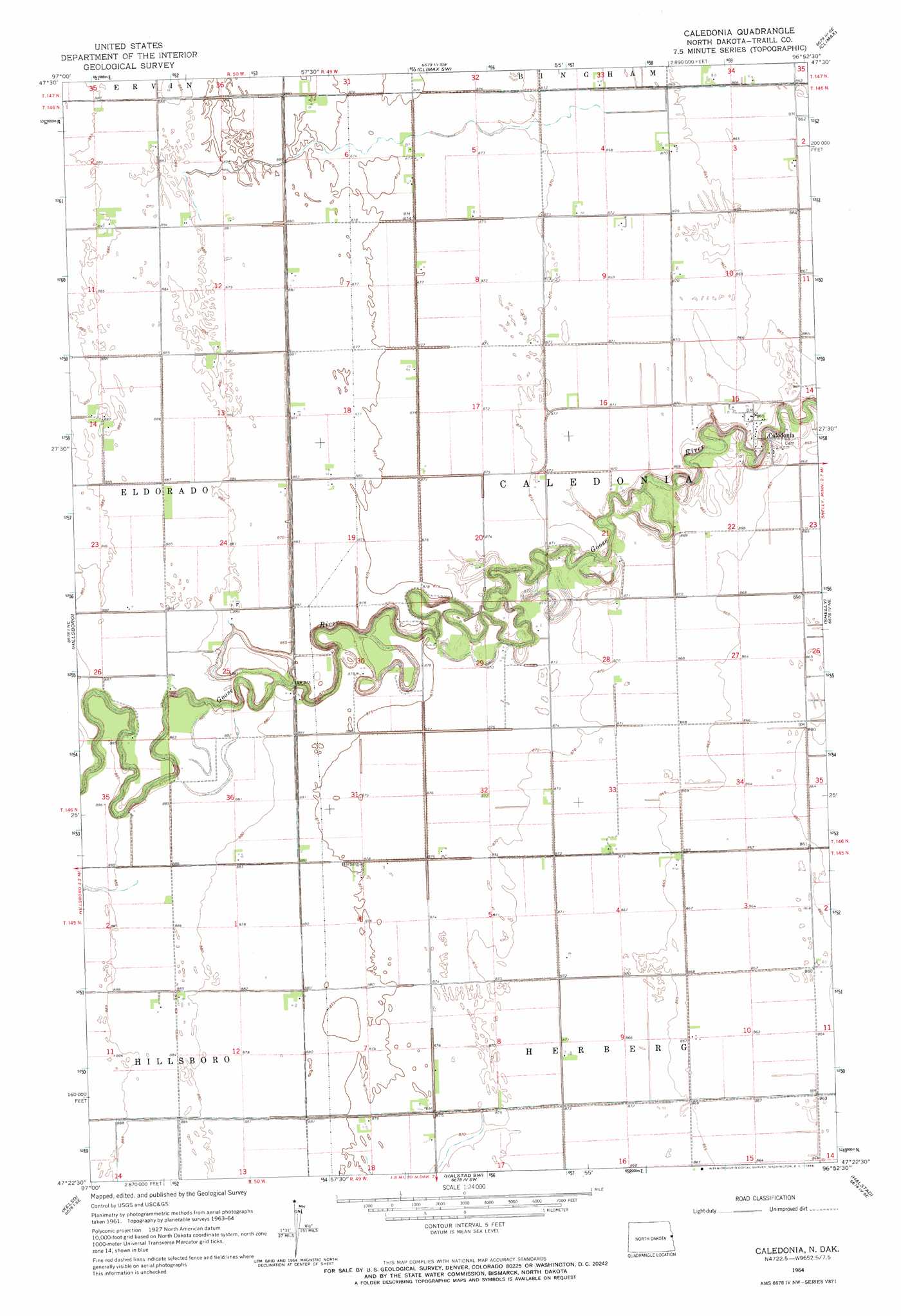
USGS Topo Quad 47096d8 - 1:24,000 scale
| Topo Map Name: | Caledonia |
| USGS Topo Quad ID: | 47096d8 |
| Print Size: | ca. 21 1/4" wide x 27" high |
| Southeast Coordinates: | 47.375° N latitude / 96.875° W longitude |
| Map Center Coordinates: | 47.4375° N latitude / 96.9375° W longitude |
| U.S. State: | ND |
| Filename: | O47096D8.jpg |
| Download Map JPG Image: | Caledonia topo map 1:24,000 scale |
| Map Type: | Topographic |
| Topo Series: | 7.5´ |
| Map Scale: | 1:24,000 |
| Source of Map Images: | United States Geological Survey (USGS) |
| Alternate Map Versions: |
Caledonia ND 1964, updated 1966 Download PDF Buy paper map Caledonia ND 2011 Download PDF Buy paper map Caledonia ND 2014 Download PDF Buy paper map |
1:24,000 Topo Quads surrounding Caledonia
Buxton Nw |
Reynolds |
Climax Nw |
Eldred |
Girard |
Buxton Sw |
Buxton |
Climax Sw |
Climax |
Beltrami Sw |
Hillsboro Nw |
Hillsboro |
Caledonia |
Shelly |
Ada Nw |
Blanchard |
Kelso |
Halstad Sw |
Halstad |
Anthony |
Hunter |
Grandin |
Gardner |
Perley |
Felton Nw |
> Back to 47096a1 at 1:100,000 scale
> Back to 47096a1 at 1:250,000 scale
> Back to U.S. Topo Maps home
Caledonia digital topo map on disk
Buy this Caledonia topo map showing relief, roads, GPS coordinates and other geographical features, as a high-resolution digital map file on DVD:
Eastern North Dakota & Eastern South Dakota
Buy digital topo maps: Eastern North Dakota & Eastern South Dakota