Dugdale Topo Map Minnesota
To zoom in, hover over the map of Dugdale
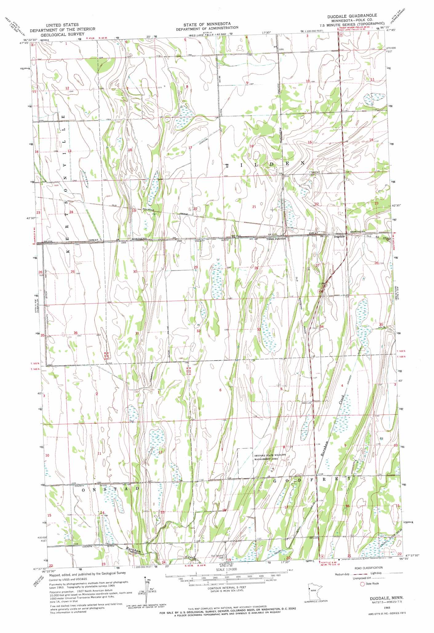
USGS Topo Quad 47096f3 - 1:24,000 scale
| Topo Map Name: | Dugdale |
| USGS Topo Quad ID: | 47096f3 |
| Print Size: | ca. 21 1/4" wide x 27" high |
| Southeast Coordinates: | 47.625° N latitude / 96.25° W longitude |
| Map Center Coordinates: | 47.6875° N latitude / 96.3125° W longitude |
| U.S. State: | MN |
| Filename: | o47096f3.jpg |
| Download Map JPG Image: | Dugdale topo map 1:24,000 scale |
| Map Type: | Topographic |
| Topo Series: | 7.5´ |
| Map Scale: | 1:24,000 |
| Source of Map Images: | United States Geological Survey (USGS) |
| Alternate Map Versions: |
Dugdale MN 1965, updated 1966 Download PDF Buy paper map Dugdale MN 2010 Download PDF Buy paper map Dugdale MN 2013 Download PDF Buy paper map Dugdale MN 2016 Download PDF Buy paper map |
1:24,000 Topo Quads surrounding Dugdale
Crookston Ne |
Dorothy |
Red Lake Falls |
Plummer Nw |
Plummer |
Crookston |
Gentilly |
Marcoux Corners |
Terrebonne |
Brooks |
Greenview |
Harold |
Dugdale |
Mentor |
Erskine |
Beltrami |
Melvin |
Fertile |
Halverson Lake |
Union Lake |
Lockhart |
Twin Valley Nw |
Flaming |
Ranum |
Faith Ne |
> Back to 47096e1 at 1:100,000 scale
> Back to 47096a1 at 1:250,000 scale
> Back to U.S. Topo Maps home
Dugdale topo map: Gazetteer
Dugdale: Canals
County Ditch Number One Hundred Forty elevation 330m 1082′County Ditch Number One Hundred Twentynine elevation 317m 1040′
County Ditch Number Seventytwo elevation 345m 1131′
Judicial Ditch Number Sixtysix elevation 330m 1082′
Dugdale: Parks
Shypoke State Wildlife Management Area elevation 337m 1105′Dugdale: Populated Places
Dugdale elevation 346m 1135′Tilden Junction elevation 340m 1115′
Dugdale: Post Offices
Dugdale Post Office (historical) elevation 346m 1135′Leeston Post Office (historical) elevation 346m 1135′
Tilden Post Office (historical) elevation 340m 1115′
Dugdale digital topo map on disk
Buy this Dugdale topo map showing relief, roads, GPS coordinates and other geographical features, as a high-resolution digital map file on DVD:
Eastern North Dakota & Eastern South Dakota
Buy digital topo maps: Eastern North Dakota & Eastern South Dakota