Emerado Topo Map North Dakota
To zoom in, hover over the map of Emerado
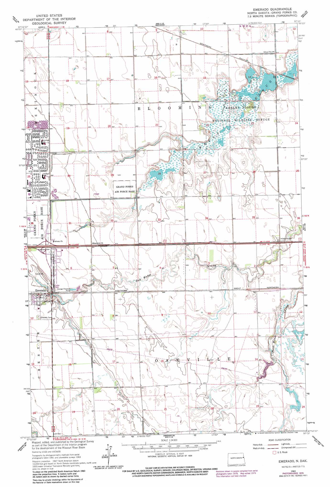
USGS Topo Quad 47097h3 - 1:24,000 scale
| Topo Map Name: | Emerado |
| USGS Topo Quad ID: | 47097h3 |
| Print Size: | ca. 21 1/4" wide x 27" high |
| Southeast Coordinates: | 47.875° N latitude / 97.25° W longitude |
| Map Center Coordinates: | 47.9375° N latitude / 97.3125° W longitude |
| U.S. State: | ND |
| Filename: | O47097H3.jpg |
| Download Map JPG Image: | Emerado topo map 1:24,000 scale |
| Map Type: | Topographic |
| Topo Series: | 7.5´ |
| Map Scale: | 1:24,000 |
| Source of Map Images: | United States Geological Survey (USGS) |
| Alternate Map Versions: |
Emerado ND 1963, updated 1964 Download PDF Buy paper map Emerado ND 1963, updated 1980 Download PDF Buy paper map Emerado ND 2011 Download PDF Buy paper map Emerado ND 2014 Download PDF Buy paper map |
1:24,000 Topo Quads surrounding Emerado
Inkster Ne |
Forest River |
Ardoch |
Oslo |
Oslo Ne |
Inkster Se |
Gilby |
Mekinock |
Manvel |
Oslo Se |
Larimore East |
Arvilla |
Emerado |
Kelly |
Grand Forks |
Kempton |
Emerado Sw |
Emerado Se |
Grand Forks Sw |
Thompson |
Northwood |
Hatton |
Holmes |
Buxton Nw |
Reynolds |
> Back to 47097e1 at 1:100,000 scale
> Back to 47096a1 at 1:250,000 scale
> Back to U.S. Topo Maps home
Emerado topo map: Gazetteer
Emerado: Dams
Anderson Dam elevation 263m 862′Kellys Slough Dam elevation 252m 826′
Emerado: Parks
Kellys Slough National Wildlife Refuge elevation 253m 830′Emerado: Populated Places
Emerado elevation 273m 895′Ojata (historical) elevation 262m 859′
Emerado: Reservoirs
Kellys Slough Reservoir elevation 252m 826′Emerado: Streams
Hazen Brook elevation 273m 895′Emerado digital topo map on disk
Buy this Emerado topo map showing relief, roads, GPS coordinates and other geographical features, as a high-resolution digital map file on DVD:
Eastern North Dakota & Eastern South Dakota
Buy digital topo maps: Eastern North Dakota & Eastern South Dakota