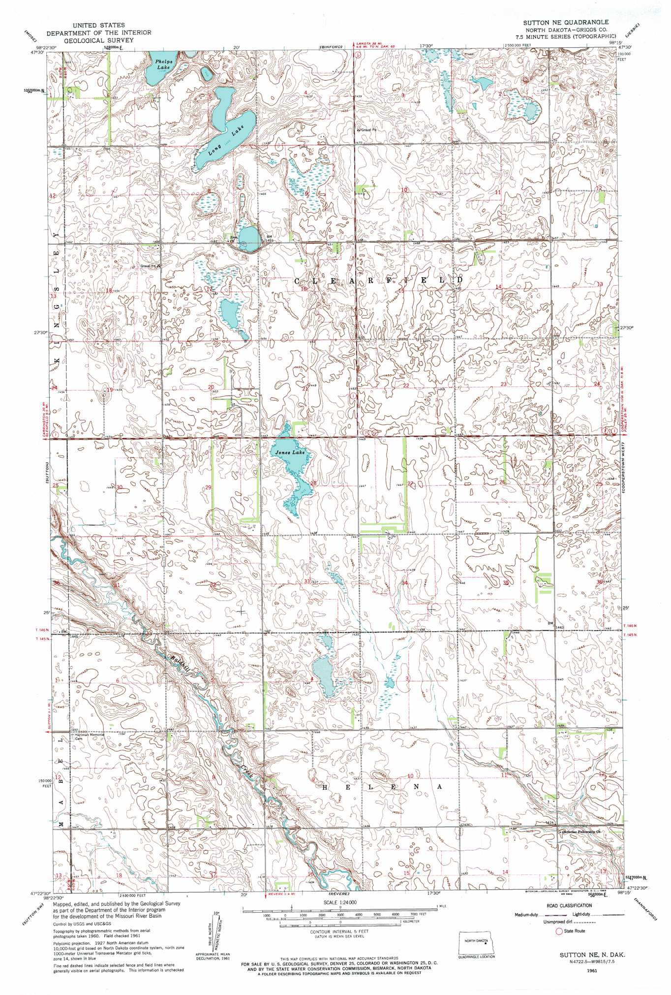
Sutton Ne Topo Map North Dakota
To zoom in, hover over the map of Sutton Ne
USGS Topo Quad 47098d3 - 1:24,000 scale
| Topo Map Name: | Sutton Ne |
| USGS Topo Quad ID: | 47098d3 |
| Print Size: | ca. 21 1/4" wide x 27" high |
| Southeast Coordinates: | 47.375° N latitude / 98.25° W longitude |
| Map Center Coordinates: | 47.4375° N latitude / 98.3125° W longitude |
| U.S. State: | ND |
| Filename: | O47098D3.jpg |
| Download Map JPG Image: | Sutton Ne topo map 1:24,000 scale |
| Map Type: | Topographic |
| Topo Series: | 7.5´ |
| Map Scale: | 1:24,000 |
| Source of Map Images: | United States Geological Survey (USGS) |
| Alternate Map Versions: |
Sutton NE ND 1961, updated 1963 Download PDF Buy paper map Sutton NE ND 2011 Download PDF Buy paper map Sutton NE ND 2014 Download PDF Buy paper map |
1:24,000 Topo Quads surrounding Sutton Ne
Johnson Lake |
Binford Nw |
Binford Ne |
Kloten Nw |
Kloten |
Mchenry |
Mose |
Binford |
Jessie |
Kloten Se |
Glenfield |
Sutton |
Sutton Ne |
Cooperstown West |
Cooperstown East |
Kensal Se |
Sutton Sw |
Revere |
Hannaford |
Karnak |
Courtenay |
Wimbledon |
Wimbledon Ne |
Dazey |
Dazey Ne |
> Back to 47098a1 at 1:100,000 scale
> Back to 47098a1 at 1:250,000 scale
> Back to U.S. Topo Maps home
Sutton Ne topo map: Gazetteer
Sutton Ne: Lakes
Jones Lake elevation 438m 1437′Long Lake elevation 441m 1446′
Phelps Lake elevation 442m 1450′
Sutton Ne digital topo map on disk
Buy this Sutton Ne topo map showing relief, roads, GPS coordinates and other geographical features, as a high-resolution digital map file on DVD:
Eastern North Dakota & Eastern South Dakota
Buy digital topo maps: Eastern North Dakota & Eastern South Dakota