Binford Topo Map North Dakota
To zoom in, hover over the map of Binford
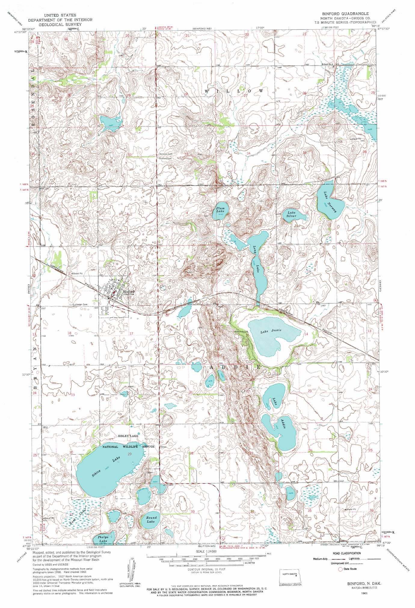
USGS Topo Quad 47098e3 - 1:24,000 scale
| Topo Map Name: | Binford |
| USGS Topo Quad ID: | 47098e3 |
| Print Size: | ca. 21 1/4" wide x 27" high |
| Southeast Coordinates: | 47.5° N latitude / 98.25° W longitude |
| Map Center Coordinates: | 47.5625° N latitude / 98.3125° W longitude |
| U.S. State: | ND |
| Filename: | O47098E3.jpg |
| Download Map JPG Image: | Binford topo map 1:24,000 scale |
| Map Type: | Topographic |
| Topo Series: | 7.5´ |
| Map Scale: | 1:24,000 |
| Source of Map Images: | United States Geological Survey (USGS) |
| Alternate Map Versions: |
Binford ND 1961, updated 1963 Download PDF Buy paper map Binford ND 2011 Download PDF Buy paper map Binford ND 2014 Download PDF Buy paper map |
1:24,000 Topo Quads surrounding Binford
Hamar |
Tolna |
Pekin |
Mcville |
Mcville Se |
Johnson Lake |
Binford Nw |
Binford Ne |
Kloten Nw |
Kloten |
Mchenry |
Mose |
Binford |
Jessie |
Kloten Se |
Glenfield |
Sutton |
Sutton Ne |
Cooperstown West |
Cooperstown East |
Kensal Se |
Sutton Sw |
Revere |
Hannaford |
Karnak |
> Back to 47098e1 at 1:100,000 scale
> Back to 47098a1 at 1:250,000 scale
> Back to U.S. Topo Maps home
Binford topo map: Gazetteer
Binford: Lakes
Lake Addie elevation 431m 1414′Lake Jessie elevation 434m 1423′
Lake Norway elevation 436m 1430′
Lake Silver elevation 438m 1437′
Long Lake elevation 440m 1443′
Plum Lake elevation 439m 1440′
Round Lake elevation 443m 1453′
Sibley Lake elevation 444m 1456′
Binford: Parks
Sibley Lake National Wildlife Refuge elevation 446m 1463′Binford: Populated Places
Binford elevation 465m 1525′Binford: Swamps
Rush Lake elevation 444m 1456′Binford digital topo map on disk
Buy this Binford topo map showing relief, roads, GPS coordinates and other geographical features, as a high-resolution digital map file on DVD:
Eastern North Dakota & Eastern South Dakota
Buy digital topo maps: Eastern North Dakota & Eastern South Dakota