Johnson Lake Topo Map North Dakota
To zoom in, hover over the map of Johnson Lake
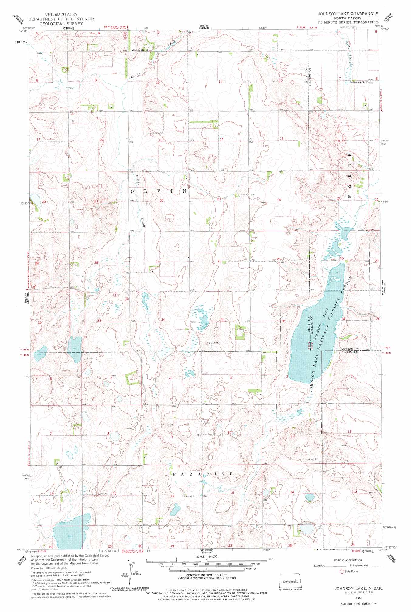
USGS Topo Quad 47098f5 - 1:24,000 scale
| Topo Map Name: | Johnson Lake |
| USGS Topo Quad ID: | 47098f5 |
| Print Size: | ca. 21 1/4" wide x 27" high |
| Southeast Coordinates: | 47.625° N latitude / 98.5° W longitude |
| Map Center Coordinates: | 47.6875° N latitude / 98.5625° W longitude |
| U.S. State: | ND |
| Filename: | O47098F5.jpg |
| Download Map JPG Image: | Johnson Lake topo map 1:24,000 scale |
| Map Type: | Topographic |
| Topo Series: | 7.5´ |
| Map Scale: | 1:24,000 |
| Source of Map Images: | United States Geological Survey (USGS) |
| Alternate Map Versions: |
Johnson Lake ND 1961, updated 1963 Download PDF Buy paper map Johnson Lake ND 1961, updated 1978 Download PDF Buy paper map Johnson Lake ND 2011 Download PDF Buy paper map Johnson Lake ND 2014 Download PDF Buy paper map |
1:24,000 Topo Quads surrounding Johnson Lake
Tokio |
Free Peoples Lake |
Devils Lake Mountain |
Pekin Nw |
Pekin Ne |
Horseshoe Lake |
Warwick |
Hamar |
Tolna |
Pekin |
Brantford Ne |
Lake Coe |
Johnson Lake |
Binford Nw |
Binford Ne |
Grace City |
Juanita |
Mchenry |
Mose |
Binford |
Bordulac Ne |
Kensal Nw |
Glenfield |
Sutton |
Sutton Ne |
> Back to 47098e1 at 1:100,000 scale
> Back to 47098a1 at 1:250,000 scale
> Back to U.S. Topo Maps home
Johnson Lake topo map: Gazetteer
Johnson Lake: Guts
Kelly Slough elevation 448m 1469′Johnson Lake: Lakes
Johnson Lake elevation 450m 1476′Johnson Lake: Parks
Johnson Lake National Wildlife Refuge elevation 450m 1476′Johnson Lake digital topo map on disk
Buy this Johnson Lake topo map showing relief, roads, GPS coordinates and other geographical features, as a high-resolution digital map file on DVD:
Eastern North Dakota & Eastern South Dakota
Buy digital topo maps: Eastern North Dakota & Eastern South Dakota