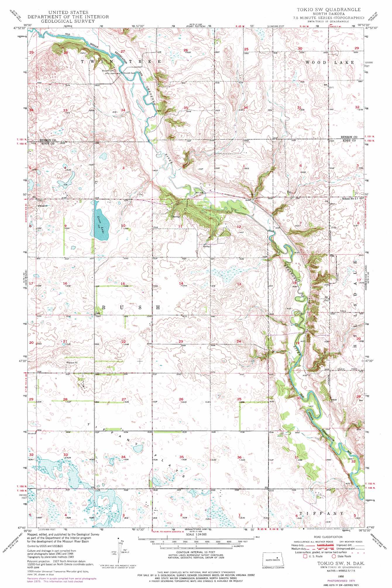
Tokio Sw Topo Map North Dakota
To zoom in, hover over the map of Tokio Sw
USGS Topo Quad 47098g8 - 1:24,000 scale
| Topo Map Name: | Tokio Sw |
| USGS Topo Quad ID: | 47098g8 |
| Print Size: | ca. 21 1/4" wide x 27" high |
| Southeast Coordinates: | 47.75° N latitude / 98.875° W longitude |
| Map Center Coordinates: | 47.8125° N latitude / 98.9375° W longitude |
| U.S. State: | ND |
| Filename: | O47098G8.jpg |
| Download Map JPG Image: | Tokio Sw topo map 1:24,000 scale |
| Map Type: | Topographic |
| Topo Series: | 7.5´ |
| Map Scale: | 1:24,000 |
| Source of Map Images: | United States Geological Survey (USGS) |
| Alternate Map Versions: |
Tokio SW ND 1950 Download PDF Buy paper map Tokio SW ND 1975, updated 1977 Download PDF Buy paper map Tokio SW ND 2011 Download PDF Buy paper map Tokio SW ND 2014 Download PDF Buy paper map |
1:24,000 Topo Quads surrounding Tokio Sw
Minnewauken East |
Grahams Island |
Camp Grafton |
Devils Lake |
Crary |
Oberon |
Crow Hill |
Fort Totten |
Tokio |
Free Peoples Lake |
Oberon Sw |
Sheyenne |
Tokio Sw |
Horseshoe Lake |
Warwick |
New Rockford |
New Rockford Ne |
Brantford Nw |
Brantford Ne |
Lake Coe |
Barlow |
New Rockford Se |
Brantford |
Grace City |
Juanita |
> Back to 47098e1 at 1:100,000 scale
> Back to 47098a1 at 1:250,000 scale
> Back to U.S. Topo Maps home
Tokio Sw topo map: Gazetteer
Tokio Sw: Dams
Bouret Dam elevation 430m 1410′Bourett Dam elevation 429m 1407′
Tokio Sw: Lakes
Goose Lake elevation 460m 1509′Tokio Sw digital topo map on disk
Buy this Tokio Sw topo map showing relief, roads, GPS coordinates and other geographical features, as a high-resolution digital map file on DVD:
Eastern North Dakota & Eastern South Dakota
Buy digital topo maps: Eastern North Dakota & Eastern South Dakota