Goldwin Sw Topo Map North Dakota
To zoom in, hover over the map of Goldwin Sw
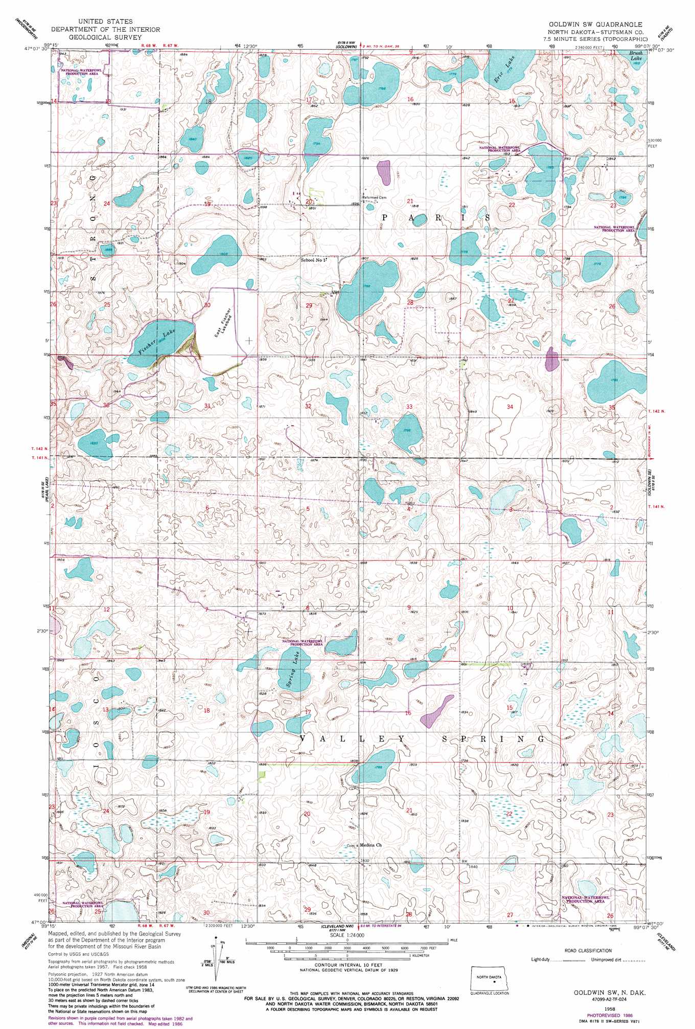
USGS Topo Quad 47099a2 - 1:24,000 scale
| Topo Map Name: | Goldwin Sw |
| USGS Topo Quad ID: | 47099a2 |
| Print Size: | ca. 21 1/4" wide x 27" high |
| Southeast Coordinates: | 47° N latitude / 99.125° W longitude |
| Map Center Coordinates: | 47.0625° N latitude / 99.1875° W longitude |
| U.S. State: | ND |
| Filename: | O47099A2.jpg |
| Download Map JPG Image: | Goldwin Sw topo map 1:24,000 scale |
| Map Type: | Topographic |
| Topo Series: | 7.5´ |
| Map Scale: | 1:24,000 |
| Source of Map Images: | United States Geological Survey (USGS) |
| Alternate Map Versions: |
Goldwin SW ND 1958, updated 1959 Download PDF Buy paper map Goldwin SW ND 1958, updated 1986 Download PDF Buy paper map Goldwin SW ND 2011 Download PDF Buy paper map Goldwin SW ND 2014 Download PDF Buy paper map |
1:24,000 Topo Quads surrounding Goldwin Sw
Sykeston Sw |
Hawks Nest |
Carrington Sw |
Melville |
Bordulac Sw |
Woodworth Nw |
Woodworth |
Goldwin |
Vashti |
Pingree |
Lake Louise |
Pearl Lake |
Goldwin Sw |
Goldwin Se |
Pingree Sw |
Crystal Springs |
Medina |
Cleveland Nw |
Cleveland |
Eldridge Nw |
Medina Sw |
Medina Se |
Cleveland Sw |
Cleveland Se |
Eldridge Sw |
> Back to 47099a1 at 1:100,000 scale
> Back to 47098a1 at 1:250,000 scale
> Back to U.S. Topo Maps home
Goldwin Sw topo map: Gazetteer
Goldwin Sw: Dams
Redlin Dam elevation 561m 1840′Goldwin Sw: Lakes
Brush Lake elevation 553m 1814′East Fischer Lake elevation 550m 1804′
Eric Lake elevation 543m 1781′
Fischer Lake elevation 551m 1807′
Spring Lake elevation 551m 1807′
Goldwin Sw digital topo map on disk
Buy this Goldwin Sw topo map showing relief, roads, GPS coordinates and other geographical features, as a high-resolution digital map file on DVD:
Eastern North Dakota & Eastern South Dakota
Buy digital topo maps: Eastern North Dakota & Eastern South Dakota