Fessenden Sw Topo Map North Dakota
To zoom in, hover over the map of Fessenden Sw
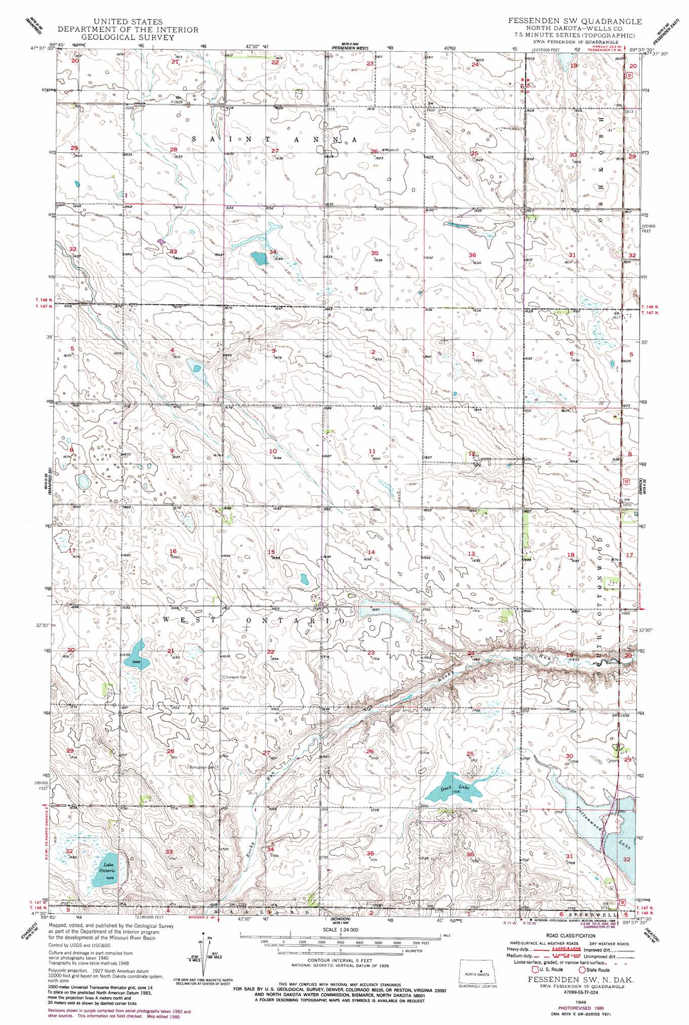
USGS Topo Quad 47099e6 - 1:24,000 scale
| Topo Map Name: | Fessenden Sw |
| USGS Topo Quad ID: | 47099e6 |
| Print Size: | ca. 21 1/4" wide x 27" high |
| Southeast Coordinates: | 47.5° N latitude / 99.625° W longitude |
| Map Center Coordinates: | 47.5625° N latitude / 99.6875° W longitude |
| U.S. State: | ND |
| Filename: | O47099E6.jpg |
| Download Map JPG Image: | Fessenden Sw topo map 1:24,000 scale |
| Map Type: | Topographic |
| Topo Series: | 7.5´ |
| Map Scale: | 1:24,000 |
| Source of Map Images: | United States Geological Survey (USGS) |
| Alternate Map Versions: |
Fessenden SW ND 1949, updated 1949 Download PDF Buy paper map Fessenden SW ND 1949, updated 1986 Download PDF Buy paper map Fessenden SW ND 2011 Download PDF Buy paper map Fessenden SW ND 2014 Download PDF Buy paper map |
1:24,000 Topo Quads surrounding Fessenden Sw
Harvey |
Wellsburg |
Heimdal |
Hamberg |
Black Hammer Hill |
Manfred Nw |
Manfred |
Fessenden West |
Fessenden East |
Bremen |
Manfred Sw |
Manfred Se |
Fessenden Sw |
Emrick |
Cathay |
Hurdsfield |
Chaseley |
Bowden |
Heaton |
Sykeston |
Senior Lake |
Willow Lake |
Wagon Wheel Hill |
Bowden Se |
Sykeston Sw |
> Back to 47099e1 at 1:100,000 scale
> Back to 47098a1 at 1:250,000 scale
> Back to U.S. Topo Maps home
Fessenden Sw topo map: Gazetteer
Fessenden Sw: Lakes
Cottonwood Lake elevation 518m 1699′Duck Lake elevation 520m 1706′
Lake Ontario elevation 514m 1686′
Fessenden Sw digital topo map on disk
Buy this Fessenden Sw topo map showing relief, roads, GPS coordinates and other geographical features, as a high-resolution digital map file on DVD:
Eastern North Dakota & Eastern South Dakota
Buy digital topo maps: Eastern North Dakota & Eastern South Dakota