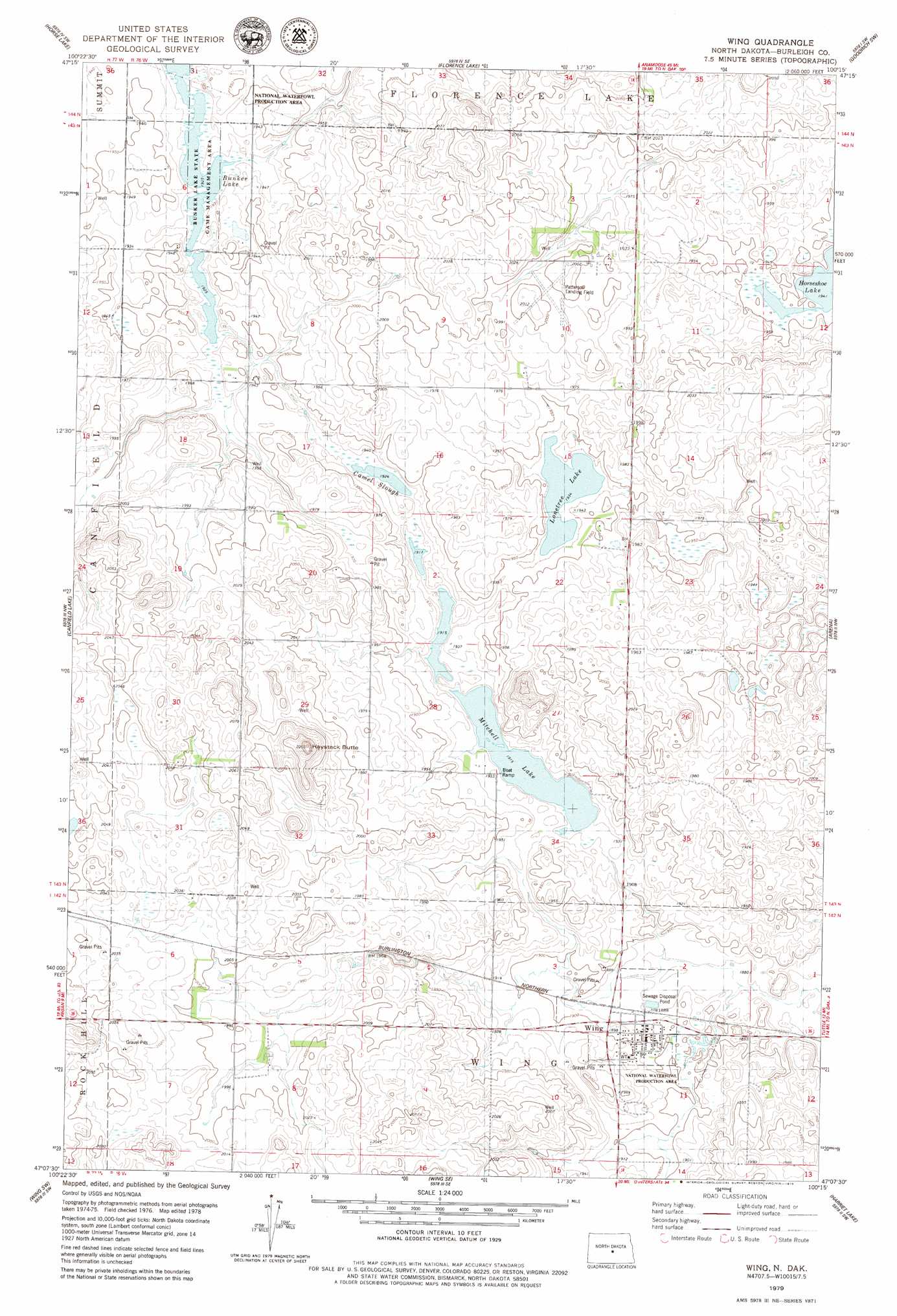
Wing Topo Map North Dakota
To zoom in, hover over the map of Wing
USGS Topo Quad 47100b3 - 1:24,000 scale
| Topo Map Name: | Wing |
| USGS Topo Quad ID: | 47100b3 |
| Print Size: | ca. 21 1/4" wide x 27" high |
| Southeast Coordinates: | 47.125° N latitude / 100.25° W longitude |
| Map Center Coordinates: | 47.1875° N latitude / 100.3125° W longitude |
| U.S. State: | ND |
| Filename: | O47100B3.jpg |
| Download Map JPG Image: | Wing topo map 1:24,000 scale |
| Map Type: | Topographic |
| Topo Series: | 7.5´ |
| Map Scale: | 1:24,000 |
| Source of Map Images: | United States Geological Survey (USGS) |
| Alternate Map Versions: |
Wing ND 1979, updated 1979 Download PDF Buy paper map Wing ND 2011 Download PDF Buy paper map Wing ND 2014 Download PDF Buy paper map |
1:24,000 Topo Quads surrounding Wing
Pickardville |
Mcclusky |
Denhoff |
Goodrich West |
Goodrich East |
Mercer Se |
Horse Lake |
Florence Lake |
Goodrich Sw |
Woodhouse Lake |
Regan |
Canfield Lake |
Wing |
Arena |
Lake Helen |
Regan Se |
Wing Sw |
Wing Se |
Harriet Lake |
Harriet Lake Se |
Solberg Butte |
Mckenzie Nw |
Sibley Butte |
Clear Lake |
Stony Slough |
> Back to 47100a1 at 1:100,000 scale
> Back to 47100a1 at 1:250,000 scale
> Back to U.S. Topo Maps home
Wing topo map: Gazetteer
Wing: Airports
Patterson Hereford Ranch Landing Field elevation 608m 1994′Wing: Lakes
Bunker Lake elevation 587m 1925′Camel Slough elevation 587m 1925′
Lonetree Lake elevation 590m 1935′
Mitchell Lake elevation 584m 1916′
Wing: Parks
Bunker Lake State Game Management Area elevation 587m 1925′Wing: Populated Places
Wing elevation 580m 1902′Wing: Summits
Haystack Butte elevation 668m 2191′Wing digital topo map on disk
Buy this Wing topo map showing relief, roads, GPS coordinates and other geographical features, as a high-resolution digital map file on DVD:
Eastern North Dakota & Eastern South Dakota
Buy digital topo maps: Eastern North Dakota & Eastern South Dakota