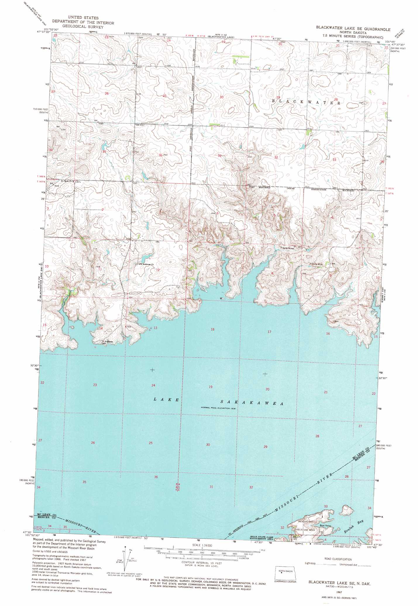
Blackwater Lake Se Topo Map North Dakota
To zoom in, hover over the map of Blackwater Lake Se
USGS Topo Quad 47101e7 - 1:24,000 scale
| Topo Map Name: | Blackwater Lake Se |
| USGS Topo Quad ID: | 47101e7 |
| Print Size: | ca. 21 1/4" wide x 27" high |
| Southeast Coordinates: | 47.5° N latitude / 101.75° W longitude |
| Map Center Coordinates: | 47.5625° N latitude / 101.8125° W longitude |
| U.S. State: | ND |
| Filename: | O47101E7.jpg |
| Download Map JPG Image: | Blackwater Lake Se topo map 1:24,000 scale |
| Map Type: | Topographic |
| Topo Series: | 7.5´ |
| Map Scale: | 1:24,000 |
| Source of Map Images: | United States Geological Survey (USGS) |
| Alternate Map Versions: |
Blackwater Lake SE ND 1967, updated 1969 Download PDF Buy paper map Blackwater Lake SE ND 2011 Download PDF Buy paper map Blackwater Lake SE ND 2014 Download PDF Buy paper map |
1:24,000 Topo Quads surrounding Blackwater Lake Se
Parshall Se |
Makoti Sw |
Roseglen |
Blue Hill |
Douglas West |
Raub |
Blackwater Lake Nw |
Blackwater Lake |
Emmet |
Emmet Ne |
Raub Se |
Blackwater Lake Sw |
Blackwater Lake Se |
Emmet Sw |
Emmet Se |
Golden Valley Ne |
Beulah Nw |
Beulah Ne |
Hazen Nw |
Hazen Ne |
Golden Valley |
Zap |
Beulah |
Hazen West |
Hazen East |
> Back to 47101e1 at 1:100,000 scale
> Back to 47100a1 at 1:250,000 scale
> Back to U.S. Topo Maps home
Blackwater Lake Se topo map: Gazetteer
Blackwater Lake Se: Islands
Little Bason Island (historical) elevation 561m 1840′Blackwater Lake Se: Parks
Beulah Bay Public Use Area elevation 580m 1902′Blackwater Lake Se digital topo map on disk
Buy this Blackwater Lake Se topo map showing relief, roads, GPS coordinates and other geographical features, as a high-resolution digital map file on DVD:
Eastern North Dakota & Eastern South Dakota
Buy digital topo maps: Eastern North Dakota & Eastern South Dakota