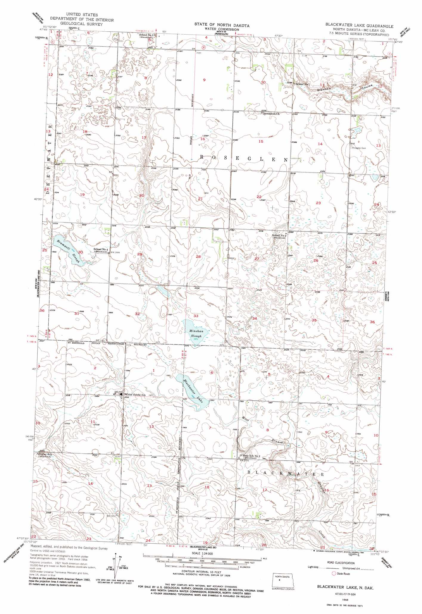
Blackwater Lake Topo Map North Dakota
To zoom in, hover over the map of Blackwater Lake
USGS Topo Quad 47101f7 - 1:24,000 scale
| Topo Map Name: | Blackwater Lake |
| USGS Topo Quad ID: | 47101f7 |
| Print Size: | ca. 21 1/4" wide x 27" high |
| Southeast Coordinates: | 47.625° N latitude / 101.75° W longitude |
| Map Center Coordinates: | 47.6875° N latitude / 101.8125° W longitude |
| U.S. State: | ND |
| Filename: | O47101F7.jpg |
| Download Map JPG Image: | Blackwater Lake topo map 1:24,000 scale |
| Map Type: | Topographic |
| Topo Series: | 7.5´ |
| Map Scale: | 1:24,000 |
| Source of Map Images: | United States Geological Survey (USGS) |
| Alternate Map Versions: |
Blackwater Lake ND 1956, updated 1957 Download PDF Buy paper map Blackwater Lake ND 1956, updated 1986 Download PDF Buy paper map Blackwater Lake ND 2011 Download PDF Buy paper map Blackwater Lake ND 2014 Download PDF Buy paper map |
1:24,000 Topo Quads surrounding Blackwater Lake
Parshall Ne |
Wabek |
Makoti |
Ryder |
Lake Vernon |
Parshall Se |
Makoti Sw |
Roseglen |
Blue Hill |
Douglas West |
Raub |
Blackwater Lake Nw |
Blackwater Lake |
Emmet |
Emmet Ne |
Raub Se |
Blackwater Lake Sw |
Blackwater Lake Se |
Emmet Sw |
Emmet Se |
Golden Valley Ne |
Beulah Nw |
Beulah Ne |
Hazen Nw |
Hazen Ne |
> Back to 47101e1 at 1:100,000 scale
> Back to 47100a1 at 1:250,000 scale
> Back to U.S. Topo Maps home
Blackwater Lake topo map: Gazetteer
Blackwater Lake: Lakes
Blackwater Lake elevation 598m 1961′Brumwell Slough elevation 603m 1978′
Minehan Slough elevation 601m 1971′
Blackwater Lake: Populated Places
White Shield elevation 610m 2001′Blackwater Lake: Streams
Glennon Coulee elevation 634m 2080′Blackwater Lake digital topo map on disk
Buy this Blackwater Lake topo map showing relief, roads, GPS coordinates and other geographical features, as a high-resolution digital map file on DVD:
Eastern North Dakota & Eastern South Dakota
Buy digital topo maps: Eastern North Dakota & Eastern South Dakota