Saddle Butte Sw Topo Map North Dakota
To zoom in, hover over the map of Saddle Butte Sw
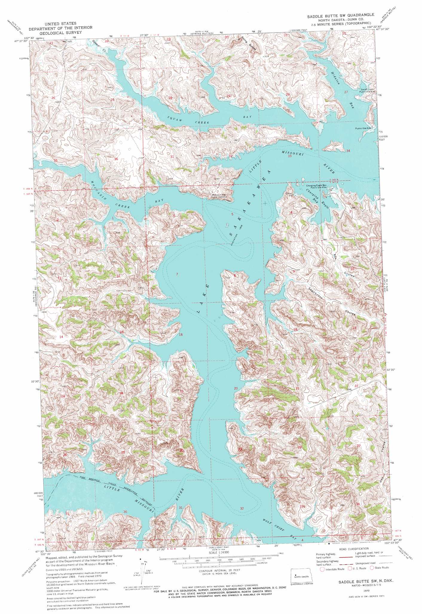
USGS Topo Quad 47102e4 - 1:24,000 scale
| Topo Map Name: | Saddle Butte Sw |
| USGS Topo Quad ID: | 47102e4 |
| Print Size: | ca. 21 1/4" wide x 27" high |
| Southeast Coordinates: | 47.5° N latitude / 102.375° W longitude |
| Map Center Coordinates: | 47.5625° N latitude / 102.4375° W longitude |
| U.S. State: | ND |
| Filename: | O47102E4.jpg |
| Download Map JPG Image: | Saddle Butte Sw topo map 1:24,000 scale |
| Map Type: | Topographic |
| Topo Series: | 7.5´ |
| Map Scale: | 1:24,000 |
| Source of Map Images: | United States Geological Survey (USGS) |
| Alternate Map Versions: |
Saddle Butte SW ND 1970, updated 1973 Download PDF Buy paper map Saddle Butte SW ND 2011 Download PDF Buy paper map Saddle Butte SW ND 2014 Download PDF Buy paper map |
1:24,000 Topo Quads surrounding Saddle Butte Sw
Sanish Sw |
Sanish Se |
New Town Sw |
New Town Se |
Parshall Sw |
Mandaree |
Mandaree Ne |
String Buttes |
Saddle Butte |
Raub Nw |
Mandaree Sw |
Mandaree Se |
Saddle Butte Sw |
Hay Flat |
Twin Buttes |
Dunn Center Nw |
Dunn Center Ne |
Halliday Nw |
Halliday Ne |
Golden Valley Nw |
Lake Ilo |
Dunn Center |
Werner |
Halliday |
Dodge |
> Back to 47102e1 at 1:100,000 scale
> Back to 47102a1 at 1:250,000 scale
> Back to U.S. Topo Maps home
Saddle Butte Sw topo map: Gazetteer
Saddle Butte Sw: Bays
Charging Eagle Bay elevation 561m 1840′Hidatsa Bay elevation 561m 1840′
Moccasin Creek Bay elevation 561m 1840′
Squaw Creek Bay elevation 561m 1840′
Wolf Chief Bay elevation 561m 1840′
Saddle Butte Sw: Parks
Charging Eagle Bay Public Use Area elevation 568m 1863′Moccasin Bay Public Use Area elevation 572m 1876′
Smith Creek Public Use Area elevation 575m 1886′
Saddle Butte Sw: Streams
Moccasin Creek elevation 561m 1840′Squaw Creek elevation 561m 1840′
Saddle Butte Sw: Valleys
Ash Coulee elevation 564m 1850′Sagebrush Coulee elevation 565m 1853′
Saddle Butte Sw digital topo map on disk
Buy this Saddle Butte Sw topo map showing relief, roads, GPS coordinates and other geographical features, as a high-resolution digital map file on DVD:
Eastern Montana & Western North Dakota
Buy digital topo maps: Eastern Montana & Western North Dakota