Mandaree Topo Map North Dakota
To zoom in, hover over the map of Mandaree
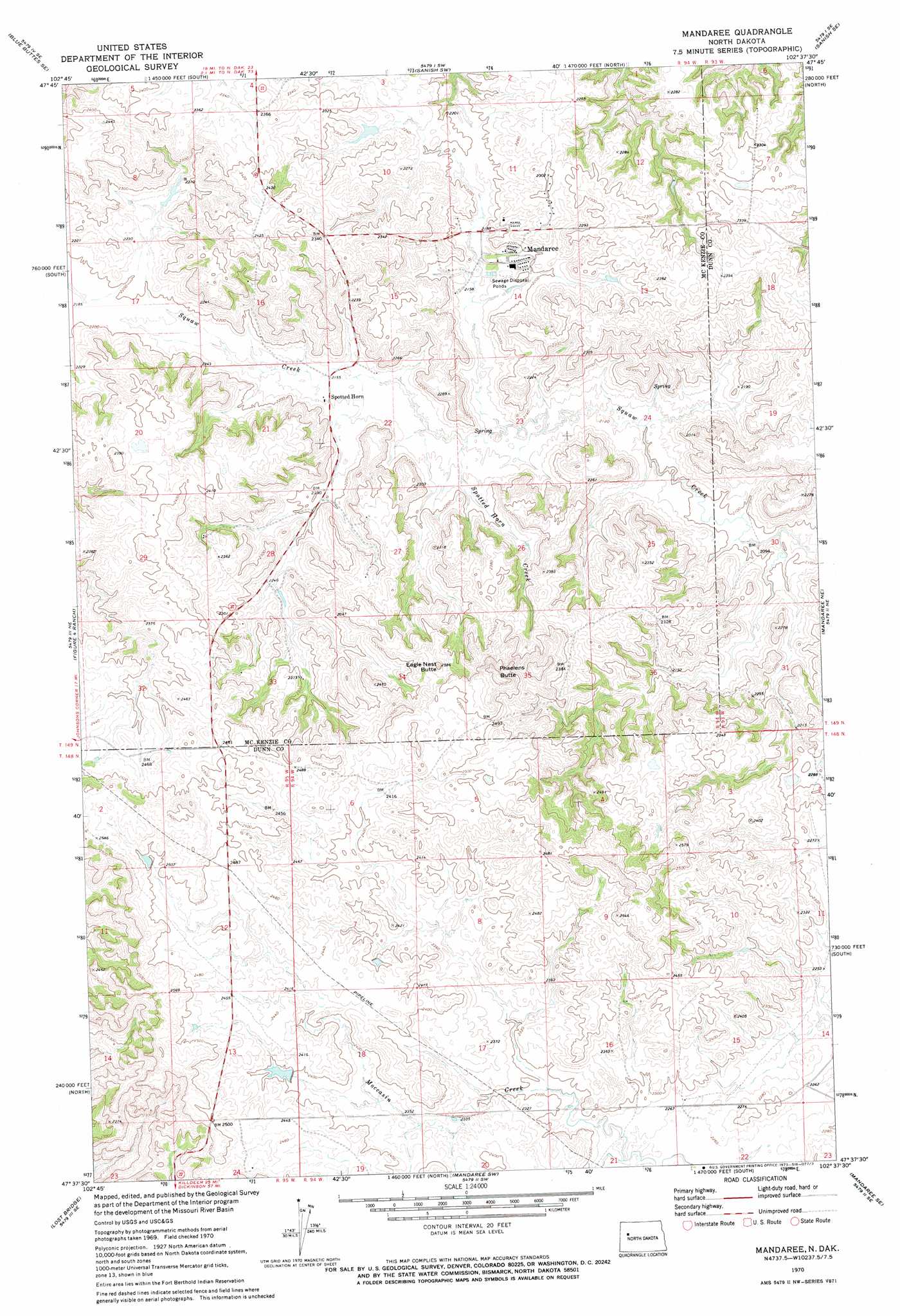
USGS Topo Quad 47102f6 - 1:24,000 scale
| Topo Map Name: | Mandaree |
| USGS Topo Quad ID: | 47102f6 |
| Print Size: | ca. 21 1/4" wide x 27" high |
| Southeast Coordinates: | 47.625° N latitude / 102.625° W longitude |
| Map Center Coordinates: | 47.6875° N latitude / 102.6875° W longitude |
| U.S. State: | ND |
| Filename: | O47102F6.jpg |
| Download Map JPG Image: | Mandaree topo map 1:24,000 scale |
| Map Type: | Topographic |
| Topo Series: | 7.5´ |
| Map Scale: | 1:24,000 |
| Source of Map Images: | United States Geological Survey (USGS) |
| Alternate Map Versions: |
Mandaree ND 1970, updated 1973 Download PDF Buy paper map Mandaree ND 2011 Download PDF Buy paper map Mandaree ND 2014 Download PDF Buy paper map |
1:24,000 Topo Quads surrounding Mandaree
Keene |
Blue Buttes |
Sanish Nw |
Sanish |
New Town |
Johnsons Corner |
Blue Buttes Se |
Sanish Sw |
Sanish Se |
New Town Sw |
Croff |
Figure 4 Ranch |
Mandaree |
Mandaree Ne |
String Buttes |
North Killdeer Mountain |
Lost Bridge |
Mandaree Sw |
Mandaree Se |
Saddle Butte Sw |
Killdeer Mountains |
Oakdale |
Dunn Center Nw |
Dunn Center Ne |
Halliday Nw |
> Back to 47102e1 at 1:100,000 scale
> Back to 47102a1 at 1:250,000 scale
> Back to U.S. Topo Maps home
Mandaree topo map: Gazetteer
Mandaree: Populated Places
Mandaree elevation 663m 2175′Spotted Horn elevation 659m 2162′
Mandaree: Streams
Spotted Horn Creek elevation 652m 2139′Mandaree: Summits
Eagle Nest Butte elevation 783m 2568′Phaelens Butte elevation 807m 2647′
Mandaree digital topo map on disk
Buy this Mandaree topo map showing relief, roads, GPS coordinates and other geographical features, as a high-resolution digital map file on DVD:
Eastern Montana & Western North Dakota
Buy digital topo maps: Eastern Montana & Western North Dakota