Blue Buttes Topo Map North Dakota
To zoom in, hover over the map of Blue Buttes
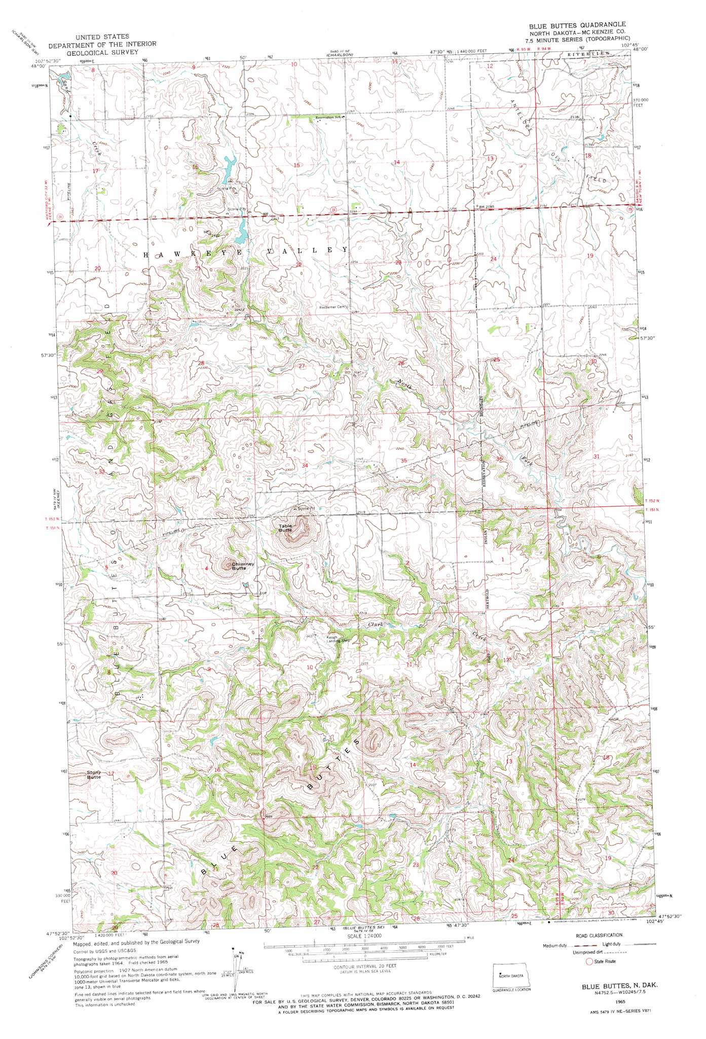
USGS Topo Quad 47102h7 - 1:24,000 scale
| Topo Map Name: | Blue Buttes |
| USGS Topo Quad ID: | 47102h7 |
| Print Size: | ca. 21 1/4" wide x 27" high |
| Southeast Coordinates: | 47.875° N latitude / 102.75° W longitude |
| Map Center Coordinates: | 47.9375° N latitude / 102.8125° W longitude |
| U.S. State: | ND |
| Filename: | O47102H7.jpg |
| Download Map JPG Image: | Blue Buttes topo map 1:24,000 scale |
| Map Type: | Topographic |
| Topo Series: | 7.5´ |
| Map Scale: | 1:24,000 |
| Source of Map Images: | United States Geological Survey (USGS) |
| Alternate Map Versions: |
Blue Buttes ND 1965, updated 1966 Download PDF Buy paper map Blue Buttes ND 1997, updated 2001 Download PDF Buy paper map Blue Buttes ND 2011 Download PDF Buy paper map Blue Buttes ND 2014 Download PDF Buy paper map |
| FStopo: | US Forest Service topo Blue Buttes is available: Download FStopo PDF Download FStopo TIF |
1:24,000 Topo Quads surrounding Blue Buttes
Red Mike Hill |
Charlson Nw |
Charlson Ne |
Rat Lake |
Robinson Lake |
Tobacco Garden Bay |
Charlson Sw |
Charlson |
Rat Lake Sw |
Rat Lake Se |
Demicks Lake |
Keene |
Blue Buttes |
Sanish Nw |
Sanish |
Schafer Se |
Johnsons Corner |
Blue Buttes Se |
Sanish Sw |
Sanish Se |
Lone Butte Ne |
Croff |
Figure 4 Ranch |
Mandaree |
Mandaree Ne |
> Back to 47102e1 at 1:100,000 scale
> Back to 47102a1 at 1:250,000 scale
> Back to U.S. Topo Maps home
Blue Buttes topo map: Gazetteer
Blue Buttes: Airports
Keogh Landing Strip elevation 706m 2316′Blue Buttes: Oilfields
Antelope Oil Field elevation 649m 2129′Blue Buttes Oil and Gas Field elevation 696m 2283′
Blue Buttes: Ranges
Blue Buttes elevation 802m 2631′Blue Buttes: Streams
North Fork Clark Creek elevation 591m 1938′Blue Buttes: Summits
Chimney Butte elevation 800m 2624′Table Butte elevation 808m 2650′
Blue Buttes digital topo map on disk
Buy this Blue Buttes topo map showing relief, roads, GPS coordinates and other geographical features, as a high-resolution digital map file on DVD:
Eastern Montana & Western North Dakota
Buy digital topo maps: Eastern Montana & Western North Dakota