Hanks Gully Topo Map North Dakota
To zoom in, hover over the map of Hanks Gully
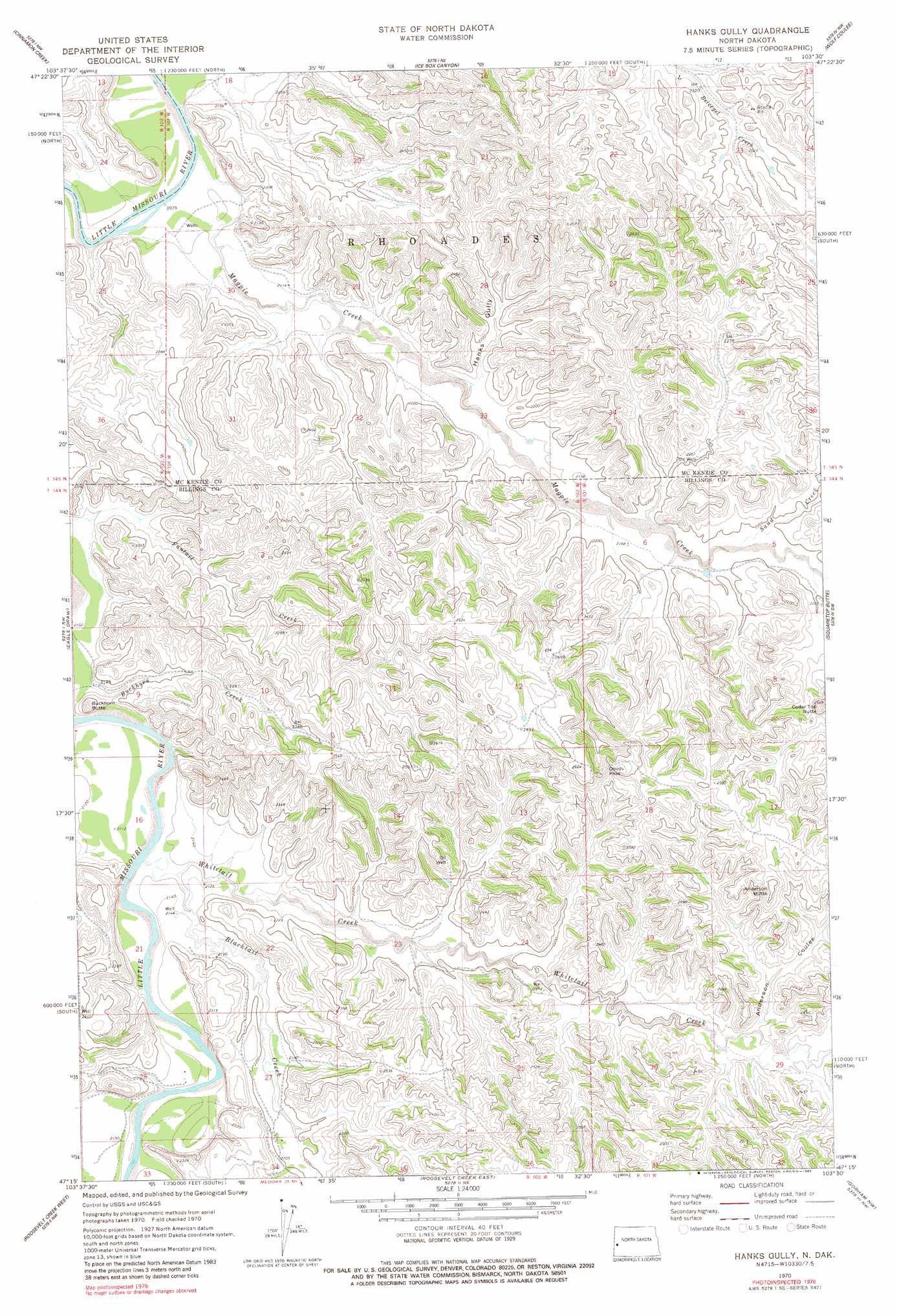
USGS Topo Quad 47103c5 - 1:24,000 scale
| Topo Map Name: | Hanks Gully |
| USGS Topo Quad ID: | 47103c5 |
| Print Size: | ca. 21 1/4" wide x 27" high |
| Southeast Coordinates: | 47.25° N latitude / 103.5° W longitude |
| Map Center Coordinates: | 47.3125° N latitude / 103.5625° W longitude |
| U.S. State: | ND |
| Filename: | O47103C5.jpg |
| Download Map JPG Image: | Hanks Gully topo map 1:24,000 scale |
| Map Type: | Topographic |
| Topo Series: | 7.5´ |
| Map Scale: | 1:24,000 |
| Source of Map Images: | United States Geological Survey (USGS) |
| Alternate Map Versions: |
Hanks Gully ND 1970, updated 1972 Download PDF Buy paper map Hanks Gully ND 1970, updated 1983 Download PDF Buy paper map Hanks Gully ND 1997, updated 2001 Download PDF Buy paper map Hanks Gully ND 2011 Download PDF Buy paper map Hanks Gully ND 2014 Download PDF Buy paper map |
| FStopo: | US Forest Service topo Hanks Gully is available: Download FStopo PDF Download FStopo TIF |
1:24,000 Topo Quads surrounding Hanks Gully
Sheep Creek |
Burning Mine Butte |
Red Wing Creek |
Sperati Point |
Long X Divide |
Flat Rock Butte |
Cinnamon Creek |
Ice Box Canyon |
Wolf Coulee |
Buckskin Butte |
Trotters Se |
Eagle Draw |
Hanks Gully |
Squaretop Butte |
Scairt Woman Draw |
Hootowl Creek East |
Roosevelt Creek West |
Roosevelt Creek East |
Gorham Nw |
Gorham |
West Twin Butte |
Wannagan Creek West |
Wannagan Creek East |
Gorham Sw |
Gorham Se |
> Back to 47103a1 at 1:100,000 scale
> Back to 47102a1 at 1:250,000 scale
> Back to U.S. Topo Maps home
Hanks Gully topo map: Gazetteer
Hanks Gully: Gaps
Devils Pass elevation 786m 2578′Hanks Gully: Oilfields
Buckhorn Oil Field elevation 695m 2280′Devils Pass Oil Field elevation 723m 2372′
Elkhorn Ranch Oil Field elevation 695m 2280′
Rough Rider Oilfield elevation 646m 2119′
Hanks Gully: Parks
Elkhorn Ranch State Historic Site elevation 647m 2122′Hanks Gully: Streams
Blacktail Creek elevation 641m 2103′Magpie Creek elevation 627m 2057′
Sand Creek elevation 663m 2175′
Whitetail Creek elevation 645m 2116′
Hanks Gully: Summits
Anderson Butte elevation 801m 2627′Buckhorn Butte elevation 689m 2260′
Cedar Top Butte elevation 780m 2559′
Hanks Gully: Valleys
Anderson Coulee elevation 679m 2227′Hanks Gully elevation 649m 2129′
Hanks Gully digital topo map on disk
Buy this Hanks Gully topo map showing relief, roads, GPS coordinates and other geographical features, as a high-resolution digital map file on DVD:
Eastern Montana & Western North Dakota
Buy digital topo maps: Eastern Montana & Western North Dakota