Trotters Topo Map North Dakota
To zoom in, hover over the map of Trotters
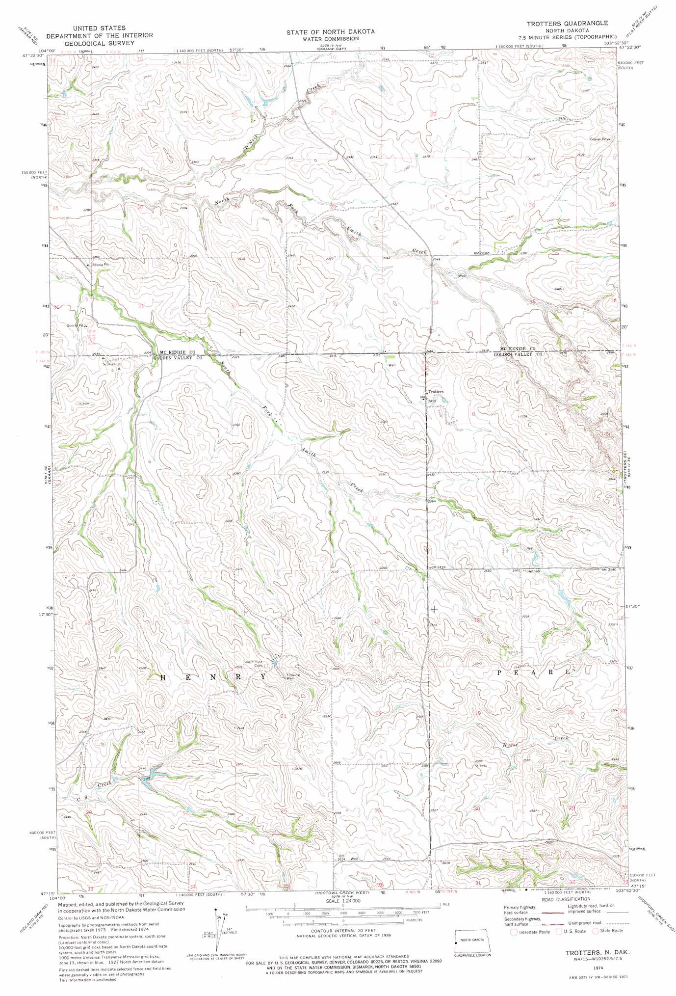
USGS Topo Quad 47103c8 - 1:24,000 scale
| Topo Map Name: | Trotters |
| USGS Topo Quad ID: | 47103c8 |
| Print Size: | ca. 21 1/4" wide x 27" high |
| Southeast Coordinates: | 47.25° N latitude / 103.875° W longitude |
| Map Center Coordinates: | 47.3125° N latitude / 103.9375° W longitude |
| U.S. State: | ND |
| Filename: | O47103C8.jpg |
| Download Map JPG Image: | Trotters topo map 1:24,000 scale |
| Map Type: | Topographic |
| Topo Series: | 7.5´ |
| Map Scale: | 1:24,000 |
| Source of Map Images: | United States Geological Survey (USGS) |
| Alternate Map Versions: |
Trotters ND 1974, updated 1977 Download PDF Buy paper map Trotters ND 1997, updated 2001 Download PDF Buy paper map Trotters ND 2011 Download PDF Buy paper map Trotters ND 2014 Download PDF Buy paper map |
| FStopo: | US Forest Service topo Trotters is available: Download FStopo PDF Download FStopo TIF |
1:24,000 Topo Quads surrounding Trotters
Piche |
Sidney Se |
Phillip Spring |
Sheep Creek |
Burning Mine Butte |
Skaar Nw |
Skaar Ne |
Squaw Gap |
Flat Rock Butte |
Cinnamon Creek |
Parson Creek |
Skaar |
Trotters |
Trotters Se |
Eagle Draw |
Odland Dam Nw |
Odland Dam Ne |
Hootowl Creek West |
Hootowl Creek East |
Roosevelt Creek West |
Odland Dam Sw |
Odland Dam |
Hootowl Creek Sw |
West Twin Butte |
Wannagan Creek West |
> Back to 47103a1 at 1:100,000 scale
> Back to 47102a1 at 1:250,000 scale
> Back to U.S. Topo Maps home
Trotters topo map: Gazetteer
Trotters: Populated Places
Trotters elevation 738m 2421′Trotters: Streams
O'Neil Creek elevation 680m 2230′Trotters digital topo map on disk
Buy this Trotters topo map showing relief, roads, GPS coordinates and other geographical features, as a high-resolution digital map file on DVD:
Eastern Montana & Western North Dakota
Buy digital topo maps: Eastern Montana & Western North Dakota