Lone Butte Topo Map North Dakota
To zoom in, hover over the map of Lone Butte
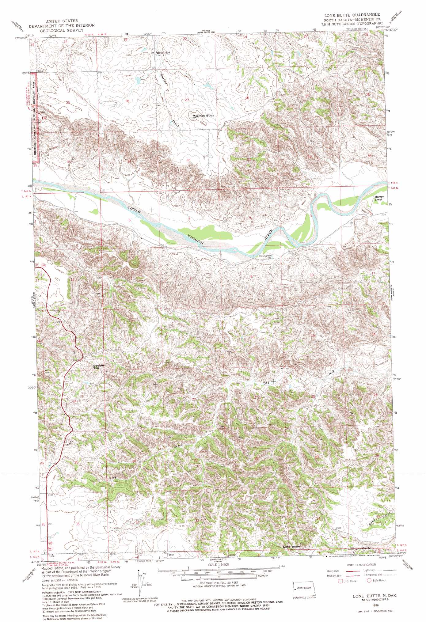
USGS Topo Quad 47103e2 - 1:24,000 scale
| Topo Map Name: | Lone Butte |
| USGS Topo Quad ID: | 47103e2 |
| Print Size: | ca. 21 1/4" wide x 27" high |
| Southeast Coordinates: | 47.5° N latitude / 103.125° W longitude |
| Map Center Coordinates: | 47.5625° N latitude / 103.1875° W longitude |
| U.S. State: | ND |
| Filename: | O47103E2.jpg |
| Download Map JPG Image: | Lone Butte topo map 1:24,000 scale |
| Map Type: | Topographic |
| Topo Series: | 7.5´ |
| Map Scale: | 1:24,000 |
| Source of Map Images: | United States Geological Survey (USGS) |
| Alternate Map Versions: |
Lone Butte ND 1958, updated 1960 Download PDF Buy paper map Lone Butte ND 1958, updated 1982 Download PDF Buy paper map Lone Butte ND 1997, updated 2001 Download PDF Buy paper map Lone Butte ND 2011 Download PDF Buy paper map Lone Butte ND 2014 Download PDF Buy paper map |
| FStopo: | US Forest Service topo Lone Butte is available: Download FStopo PDF Download FStopo TIF |
1:24,000 Topo Quads surrounding Lone Butte
Arnegard |
Watford City |
Schafer |
Schafer Se |
Johnsons Corner |
Stocke Butte |
Tepee Buttes |
Lone Butte Nw |
Lone Butte Ne |
Croff |
Sperati Point |
Long X Divide |
Lone Butte |
Lone Butte Se |
North Killdeer Mountain |
Wolf Coulee |
Buckskin Butte |
Grassy Butte |
Petes Creek |
Killdeer Mountains |
Squaretop Butte |
Scairt Woman Draw |
Grassy Butte Sw |
Grassy Butte Se |
Fayette |
> Back to 47103e1 at 1:100,000 scale
> Back to 47102a1 at 1:250,000 scale
> Back to U.S. Topo Maps home
Lone Butte topo map: Gazetteer
Lone Butte: Airports
Watson Private Airstrip elevation 785m 2575′Lone Butte: Summits
Lone Butte elevation 826m 2709′Morman Butte elevation 770m 2526′
Square Top elevation 794m 2604′
Lone Butte digital topo map on disk
Buy this Lone Butte topo map showing relief, roads, GPS coordinates and other geographical features, as a high-resolution digital map file on DVD:
Eastern Montana & Western North Dakota
Buy digital topo maps: Eastern Montana & Western North Dakota