Cluster Buttes Sw Topo Map Montana
To zoom in, hover over the map of Cluster Buttes Sw
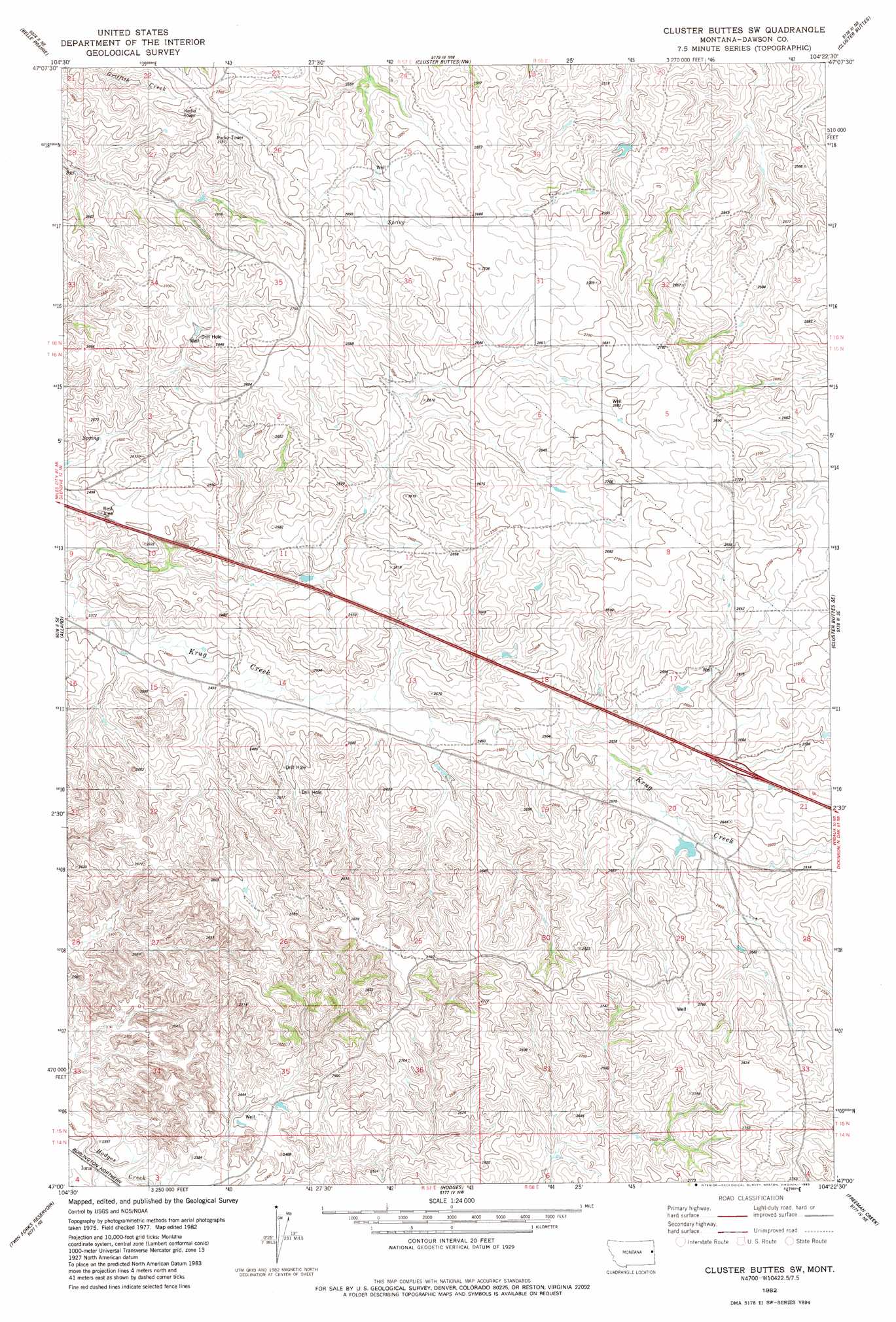
USGS Topo Quad 47104a4 - 1:24,000 scale
| Topo Map Name: | Cluster Buttes Sw |
| USGS Topo Quad ID: | 47104a4 |
| Print Size: | ca. 21 1/4" wide x 27" high |
| Southeast Coordinates: | 47° N latitude / 104.375° W longitude |
| Map Center Coordinates: | 47.0625° N latitude / 104.4375° W longitude |
| U.S. State: | MT |
| Filename: | o47104a4.jpg |
| Download Map JPG Image: | Cluster Buttes Sw topo map 1:24,000 scale |
| Map Type: | Topographic |
| Topo Series: | 7.5´ |
| Map Scale: | 1:24,000 |
| Source of Map Images: | United States Geological Survey (USGS) |
| Alternate Map Versions: |
Cluster Buttes SW MT 1982, updated 1983 Download PDF Buy paper map Cluster Buttes SW MT 2011 Download PDF Buy paper map Cluster Buttes SW MT 2014 Download PDF Buy paper map |
1:24,000 Topo Quads surrounding Cluster Buttes Sw
Kolberg Ranch |
Intake |
Savage Sw |
Savage Se |
Parson Creek |
Stipek |
Belle Prairie |
Cluster Buttes Nw |
Cluster Buttes |
Odland Dam Nw |
Glendive |
Allard |
Cluster Buttes Sw |
Cluster Buttes Se |
Odland Dam Sw |
Upper Magpie Reservoir |
Twin Forks Reservoir |
Hodges |
Freeman Creek |
Wibaux |
Graveyard Hill Sw |
Graveyard Hill |
Hodges Sw |
Hodges Se |
Red Top Butte |
> Back to 47104a1 at 1:100,000 scale
> Back to 47104a1 at 1:250,000 scale
> Back to U.S. Topo Maps home
Cluster Buttes Sw topo map: Gazetteer
Cluster Buttes Sw: Crossings
Interchange 231 elevation 789m 2588′Cluster Buttes Sw: Wells
15N57E35CC__01 Well elevation 733m 2404′15N58E01CA__01 Well elevation 823m 2700′
15N58E08BD__01 Well elevation 816m 2677′
15N58E28CADC01 Well elevation 805m 2641′
16N57E27CDA_01 Well elevation 798m 2618′
16N57E34DDC_01 Well elevation 812m 2664′
16N58E28DB__01 Well elevation 775m 2542′
Cluster Buttes Sw digital topo map on disk
Buy this Cluster Buttes Sw topo map showing relief, roads, GPS coordinates and other geographical features, as a high-resolution digital map file on DVD:
Eastern Montana & Western North Dakota
Buy digital topo maps: Eastern Montana & Western North Dakota