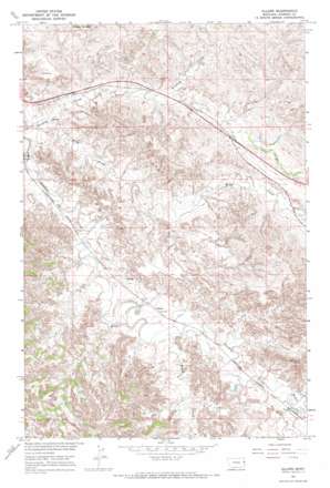
Allard Topo Map Montana
To zoom in, hover over the map of Allard
USGS Topo Quad 47104a5 - 1:24,000 scale
| Topo Map Name: | Allard |
| USGS Topo Quad ID: | 47104a5 |
| Print Size: | ca. 21 1/4" wide x 27" high |
| Southeast Coordinates: | 47° N latitude / 104.5° W longitude |
| Map Center Coordinates: | 47.0625° N latitude / 104.5625° W longitude |
| U.S. State: | MT |
| Filename: | o47104a5.jpg |
| Download Map JPG Image: | Allard topo map 1:24,000 scale |
| Map Type: | Topographic |
| Topo Series: | 7.5´ |
| Map Scale: | 1:24,000 |
| Source of Map Images: | United States Geological Survey (USGS) |
| Alternate Map Versions: |
Allard MT 1967, updated 1970 Download PDF Buy paper map Allard MT 2011 Download PDF Buy paper map Allard MT 2014 Download PDF Buy paper map |
1:24,000 Topo Quads surrounding Allard
> Back to 47104a1 at 1:100,000 scale
> Back to 47104a1 at 1:250,000 scale
> Back to U.S. Topo Maps home
Allard topo map: Gazetteer
Allard: Crossings
Interchange 224 elevation 721m 2365′Allard: Dams
Hot Bar Number 1 Dam elevation 691m 2267′Allard: Populated Places
Allard elevation 688m 2257′Allard: Post Offices
Allard Post Office (historical) elevation 688m 2257′Allard: Streams
Frank Creek elevation 675m 2214′Griffith Creek elevation 640m 2099′
Hodges Creek elevation 690m 2263′
Krug Creek elevation 647m 2122′
Allard: Valleys
Kinney Coulee elevation 652m 2139′Allard: Wells
15N56E12BBBA01 Well elevation 670m 2198′15N56E14CDBA01 Well elevation 665m 2181′
15N56E23DDCB01 Well elevation 665m 2181′
15N57E04DCCA01 Well elevation 744m 2440′
15N57E06ADBB01 Well elevation 717m 2352′
15N57E18ADDA01 Well elevation 733m 2404′
15N57E19CCAD01 Well elevation 679m 2227′
16N56E34BDCB01 Well elevation 666m 2185′
Allard digital topo map on disk
Buy this Allard topo map showing relief, roads, GPS coordinates and other geographical features, as a high-resolution digital map file on DVD:
Eastern Montana & Western North Dakota
Buy digital topo maps: Eastern Montana & Western North Dakota


