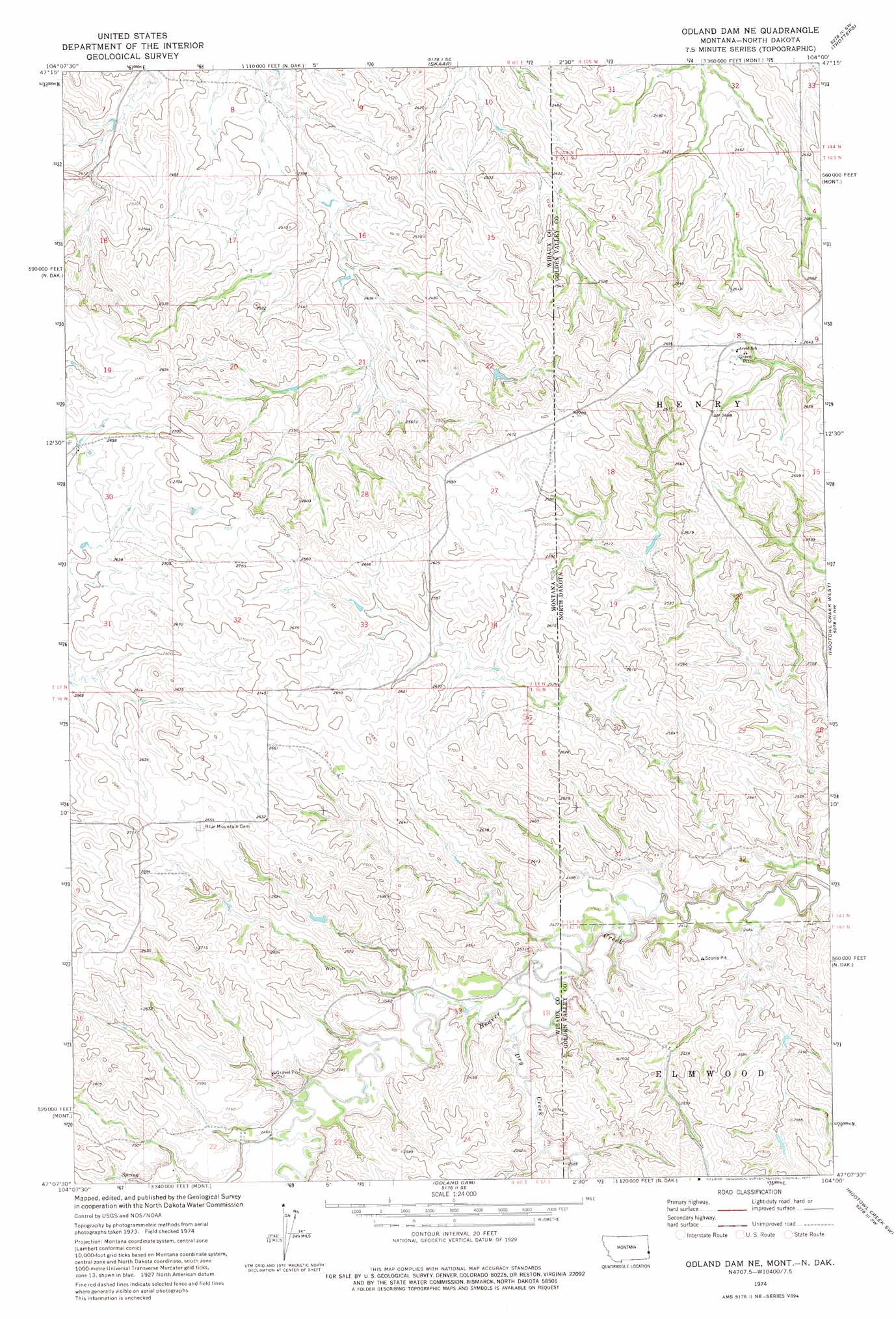
Odland Dam Ne Topo Map Montana
To zoom in, hover over the map of Odland Dam Ne
USGS Topo Quad 47104b1 - 1:24,000 scale
| Topo Map Name: | Odland Dam Ne |
| USGS Topo Quad ID: | 47104b1 |
| Print Size: | ca. 21 1/4" wide x 27" high |
| Southeast Coordinates: | 47.125° N latitude / 104° W longitude |
| Map Center Coordinates: | 47.1875° N latitude / 104.0625° W longitude |
| U.S. States: | MT, ND |
| Filename: | o47104b1.jpg |
| Download Map JPG Image: | Odland Dam Ne topo map 1:24,000 scale |
| Map Type: | Topographic |
| Topo Series: | 7.5´ |
| Map Scale: | 1:24,000 |
| Source of Map Images: | United States Geological Survey (USGS) |
| Alternate Map Versions: |
Odland Dam NE MT 1974, updated 1977 Download PDF Buy paper map Odland Dam NE MT 2011 Download PDF Buy paper map Odland Dam NE MT 2014 Download PDF Buy paper map |
1:24,000 Topo Quads surrounding Odland Dam Ne
Savage |
Skaar Nw |
Skaar Ne |
Squaw Gap |
Flat Rock Butte |
Savage Se |
Parson Creek |
Skaar |
Trotters |
Trotters Se |
Cluster Buttes |
Odland Dam Nw |
Odland Dam Ne |
Hootowl Creek West |
Hootowl Creek East |
Cluster Buttes Se |
Odland Dam Sw |
Odland Dam |
Hootowl Creek Sw |
West Twin Butte |
Freeman Creek |
Wibaux |
Beach West |
Beach East |
Sentinel Butte |
> Back to 47104a1 at 1:100,000 scale
> Back to 47104a1 at 1:250,000 scale
> Back to U.S. Topo Maps home
Odland Dam Ne topo map: Gazetteer
Odland Dam Ne: Dams
Hollar Dam elevation 807m 2647′Odland Dam Ne: Streams
Dry Creek elevation 739m 2424′Dry Creek elevation 739m 2424′
Odland Dam Ne: Wells
16N60E02BDDB01 Well elevation 815m 2673′16N60E02DBC_01 Well elevation 794m 2604′
16N60E13ABAD01 Well elevation 744m 2440′
17N60E05BBB_01 Well elevation 728m 2388′
17N60E07DCCB01 Well elevation 737m 2417′
17N60E17DCAB01 Well elevation 748m 2454′
Odland Dam Ne digital topo map on disk
Buy this Odland Dam Ne topo map showing relief, roads, GPS coordinates and other geographical features, as a high-resolution digital map file on DVD:
Eastern Montana & Western North Dakota
Buy digital topo maps: Eastern Montana & Western North Dakota