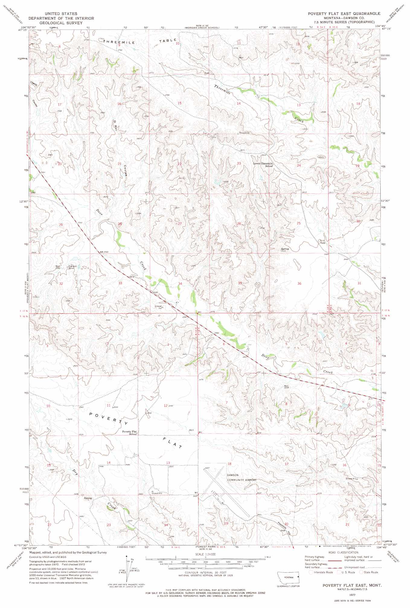
Poverty Flat East Topo Map Montana
To zoom in, hover over the map of Poverty Flat East
USGS Topo Quad 47104b7 - 1:24,000 scale
| Topo Map Name: | Poverty Flat East |
| USGS Topo Quad ID: | 47104b7 |
| Print Size: | ca. 21 1/4" wide x 27" high |
| Southeast Coordinates: | 47.125° N latitude / 104.75° W longitude |
| Map Center Coordinates: | 47.1875° N latitude / 104.8125° W longitude |
| U.S. State: | MT |
| Filename: | o47104b7.jpg |
| Download Map JPG Image: | Poverty Flat East topo map 1:24,000 scale |
| Map Type: | Topographic |
| Topo Series: | 7.5´ |
| Map Scale: | 1:24,000 |
| Source of Map Images: | United States Geological Survey (USGS) |
| Alternate Map Versions: |
Poverty Flat East MT 1972, updated 1975 Download PDF Buy paper map Poverty Flat East MT 2011 Download PDF Buy paper map Poverty Flat East MT 2014 Download PDF Buy paper map |
1:24,000 Topo Quads surrounding Poverty Flat East
Johnson Reservoir Ne |
Bloomfield |
Red Top |
Intake Nw |
Allard Ranch |
Johnson Reservoir |
Stinking Coulee |
Morgan Creek School |
Kolberg Ranch |
Intake |
Woodrow |
Poverty Flat West |
Poverty Flat East |
Stipek |
Belle Prairie |
Upper Cracker Box School |
Pleasant View |
Forest Park |
Glendive |
Allard |
Fallon Ne |
Marsh |
Hoyt |
Upper Magpie Reservoir |
Twin Forks Reservoir |
> Back to 47104a1 at 1:100,000 scale
> Back to 47104a1 at 1:250,000 scale
> Back to U.S. Topo Maps home
Poverty Flat East topo map: Gazetteer
Poverty Flat East: Airports
Dawson Community Airport elevation 749m 2457′Poverty Flat East: Mines
Gampost Mine elevation 722m 2368′Poverty Flat East: Summits
Glendive Butte elevation 802m 2631′Poverty Flat East: Valleys
D Bar Coulee elevation 700m 2296′Poverty Flat East: Wells
16N54E12CBDB01 Well elevation 757m 2483′16N54E14ADAD01 Well elevation 745m 2444′
16N55E09BBBC01 Well elevation 670m 2198′
17N54E11DBCC01 Well elevation 831m 2726′
17N54E14ADBC01 Well elevation 778m 2552′
17N54E17ACAB01 Well elevation 781m 2562′
17N54E20CCBA01 Well elevation 713m 2339′
17N54E29ACDB01 Well elevation 714m 2342′
17N55E30CC__01 Well elevation 762m 2500′
17N55E30DACC01 Well elevation 750m 2460′
Poverty Flat East digital topo map on disk
Buy this Poverty Flat East topo map showing relief, roads, GPS coordinates and other geographical features, as a high-resolution digital map file on DVD:
Eastern Montana & Western North Dakota
Buy digital topo maps: Eastern Montana & Western North Dakota