Poverty Flat West Topo Map Montana
To zoom in, hover over the map of Poverty Flat West
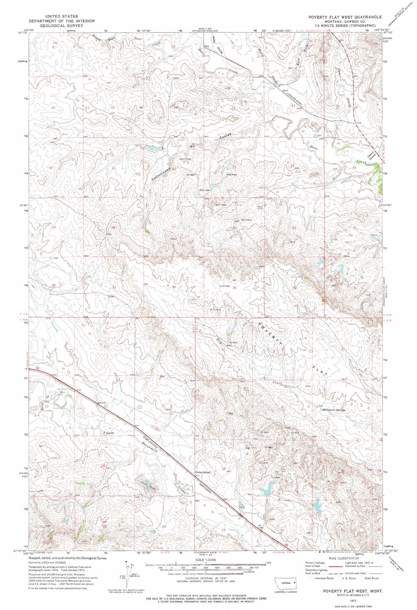
USGS Topo Quad 47104b8 - 1:24,000 scale
| Topo Map Name: | Poverty Flat West |
| USGS Topo Quad ID: | 47104b8 |
| Print Size: | ca. 21 1/4" wide x 27" high |
| Southeast Coordinates: | 47.125° N latitude / 104.875° W longitude |
| Map Center Coordinates: | 47.1875° N latitude / 104.9375° W longitude |
| U.S. State: | MT |
| Filename: | o47104b8.jpg |
| Download Map JPG Image: | Poverty Flat West topo map 1:24,000 scale |
| Map Type: | Topographic |
| Topo Series: | 7.5´ |
| Map Scale: | 1:24,000 |
| Source of Map Images: | United States Geological Survey (USGS) |
| Alternate Map Versions: |
Poverty Flat West MT 1972, updated 1975 Download PDF Buy paper map Poverty Flat West MT 2011 Download PDF Buy paper map Poverty Flat West MT 2014 Download PDF Buy paper map |
1:24,000 Topo Quads surrounding Poverty Flat West
Johnson Reservoir Nw |
Johnson Reservoir Ne |
Bloomfield |
Red Top |
Intake Nw |
Deer Creek Church |
Johnson Reservoir |
Stinking Coulee |
Morgan Creek School |
Kolberg Ranch |
Lindsay |
Woodrow |
Poverty Flat West |
Poverty Flat East |
Stipek |
Lindsay Sw |
Upper Cracker Box School |
Pleasant View |
Forest Park |
Glendive |
Hendrickson Coulee |
Fallon Ne |
Marsh |
Hoyt |
Upper Magpie Reservoir |
> Back to 47104a1 at 1:100,000 scale
> Back to 47104a1 at 1:250,000 scale
> Back to U.S. Topo Maps home
Poverty Flat West topo map: Gazetteer
Poverty Flat West: Dams
Downy Dam elevation 734m 2408′Newton Number 1 Dam elevation 760m 2493′
Quaker Dam elevation 741m 2431′
V Dam elevation 756m 2480′
Poverty Flat West: Springs
Elevenmile Springs elevation 779m 2555′Poverty Flat West: Streams
Cow Creek elevation 724m 2375′East Fork Horse Creek elevation 735m 2411′
Horse Creek elevation 733m 2404′
Poverty Flat West: Valleys
Cherry Coulee elevation 718m 2355′Cottonwood Coulee elevation 738m 2421′
Kelley Coulee elevation 739m 2424′
Poverty Flat West: Wells
16N53E10DABA01 Well elevation 759m 2490′16N53E13CCDB01 Well elevation 754m 2473′
16N53E14CC__01 Well elevation 775m 2542′
16N54E04DDCB01 Well elevation 784m 2572′
17N53E13BACB01 Well elevation 736m 2414′
17N53E13BBAC01 Well elevation 735m 2411′
17N53E14AABB01 Well elevation 736m 2414′
17N53E28CCAA01 Well elevation 819m 2687′
17N53E36BCAB01 Well elevation 848m 2782′
17N54E19DAAD01 Well elevation 716m 2349′
Poverty Flat West digital topo map on disk
Buy this Poverty Flat West topo map showing relief, roads, GPS coordinates and other geographical features, as a high-resolution digital map file on DVD:
Eastern Montana & Western North Dakota
Buy digital topo maps: Eastern Montana & Western North Dakota