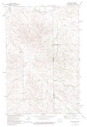
Skaar Topo Map Montana
To zoom in, hover over the map of Skaar
USGS Topo Quad 47104c1 - 1:24,000 scale
| Topo Map Name: | Skaar |
| USGS Topo Quad ID: | 47104c1 |
| Print Size: | ca. 21 1/4" wide x 27" high |
| Southeast Coordinates: | 47.25° N latitude / 104° W longitude |
| Map Center Coordinates: | 47.3125° N latitude / 104.0625° W longitude |
| U.S. States: | MT, ND |
| Filename: | o47104c1.jpg |
| Download Map JPG Image: | Skaar topo map 1:24,000 scale |
| Map Type: | Topographic |
| Topo Series: | 7.5´ |
| Map Scale: | 1:24,000 |
| Source of Map Images: | United States Geological Survey (USGS) |
| Alternate Map Versions: |
Skaar ND 1974, updated 1977 Download PDF Buy paper map Skaar ND 1997, updated 2001 Download PDF Buy paper map Skaar ND 2011 Download PDF Buy paper map Skaar ND 2014 Download PDF Buy paper map |
| FStopo: | US Forest Service topo Skaar is available: Download FStopo PDF Download FStopo TIF |
1:24,000 Topo Quads surrounding Skaar
> Back to 47104a1 at 1:100,000 scale
> Back to 47104a1 at 1:250,000 scale
> Back to U.S. Topo Maps home
Skaar topo map: Gazetteer
Skaar: Dams
Smith Creek Grazing District Dam elevation 744m 2440′White Elk Dam elevation 691m 2267′
Skaar: Populated Places
Skaar elevation 683m 2240′Skaar: Streams
C S Creek elevation 659m 2162′C S Creek elevation 659m 2162′
Deadman Creek elevation 659m 2162′
North Fork Smith Creek elevation 677m 2221′
Poison Spring Creek elevation 674m 2211′
Poison Spring Creek elevation 671m 2201′
South Fork Smith Creek elevation 677m 2221′
Skaar: Wells
18N60E04AD__01 Well elevation 731m 2398′18N60E09AAD_01 Well elevation 740m 2427′
18N60E15CBBB01 Well elevation 721m 2365′
18N60E22DCCC01 Well elevation 726m 2381′
18N60E29BDCC01 Well elevation 703m 2306′
18N60E32DADB01 Well elevation 745m 2444′
19N60E28CB__01 Well elevation 668m 2191′
19N60E32AB__01 Well elevation 668m 2191′
19N60E34BA__01 Well elevation 673m 2208′
Skaar digital topo map on disk
Buy this Skaar topo map showing relief, roads, GPS coordinates and other geographical features, as a high-resolution digital map file on DVD:
Eastern Montana & Western North Dakota
Buy digital topo maps: Eastern Montana & Western North Dakota


