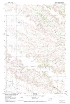
Intake Nw Topo Map Montana
To zoom in, hover over the map of Intake Nw
USGS Topo Quad 47104d6 - 1:24,000 scale
| Topo Map Name: | Intake Nw |
| USGS Topo Quad ID: | 47104d6 |
| Print Size: | ca. 21 1/4" wide x 27" high |
| Southeast Coordinates: | 47.375° N latitude / 104.625° W longitude |
| Map Center Coordinates: | 47.4375° N latitude / 104.6875° W longitude |
| U.S. State: | MT |
| Filename: | o47104d6.jpg |
| Download Map JPG Image: | Intake Nw topo map 1:24,000 scale |
| Map Type: | Topographic |
| Topo Series: | 7.5´ |
| Map Scale: | 1:24,000 |
| Source of Map Images: | United States Geological Survey (USGS) |
| Alternate Map Versions: |
Intake NW MT 1966, updated 1970 Download PDF Buy paper map Intake NW MT 1966, updated 1970 Download PDF Buy paper map Intake NW MT 2011 Download PDF Buy paper map Intake NW MT 2014 Download PDF Buy paper map |
1:24,000 Topo Quads surrounding Intake Nw
> Back to 47104a1 at 1:100,000 scale
> Back to 47104a1 at 1:250,000 scale
> Back to U.S. Topo Maps home
Intake Nw topo map: Gazetteer
Intake Nw: Springs
19N55E25ABAB01 Spring elevation 806m 2644′20N55E25CAAA01 Spring elevation 749m 2457′
Intake Nw: Wells
19N55E08DDDA01 Well elevation 783m 2568′19N55E12BDDD01 Well elevation 766m 2513′
19N55E14BCDD01 Well elevation 833m 2732′
19N55E22CACD01 Well elevation 757m 2483′
19N56E06ABCD01 Well elevation 760m 2493′
20N55E12BC__01 Well elevation 786m 2578′
20N55E15BACB01 Well elevation 772m 2532′
20N55E20CBCA01 Well elevation 840m 2755′
20N55E22BBCC01 Well elevation 834m 2736′
20N55E32AAAA01 Well elevation 823m 2700′
20N55E32AAAA02 Well elevation 823m 2700′
Intake Nw digital topo map on disk
Buy this Intake Nw topo map showing relief, roads, GPS coordinates and other geographical features, as a high-resolution digital map file on DVD:
Eastern Montana & Western North Dakota
Buy digital topo maps: Eastern Montana & Western North Dakota


