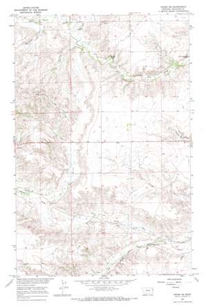
Crane Ne Topo Map Montana
To zoom in, hover over the map of Crane Ne
USGS Topo Quad 47104f3 - 1:24,000 scale
| Topo Map Name: | Crane Ne |
| USGS Topo Quad ID: | 47104f3 |
| Print Size: | ca. 21 1/4" wide x 27" high |
| Southeast Coordinates: | 47.625° N latitude / 104.25° W longitude |
| Map Center Coordinates: | 47.6875° N latitude / 104.3125° W longitude |
| U.S. State: | MT |
| Filename: | o47104f3.jpg |
| Download Map JPG Image: | Crane Ne topo map 1:24,000 scale |
| Map Type: | Topographic |
| Topo Series: | 7.5´ |
| Map Scale: | 1:24,000 |
| Source of Map Images: | United States Geological Survey (USGS) |
| Alternate Map Versions: |
Crane NE MT 1966, updated 1970 Download PDF Buy paper map Crane NE MT 2011 Download PDF Buy paper map Crane NE MT 2014 Download PDF Buy paper map |
1:24,000 Topo Quads surrounding Crane Ne
> Back to 47104e1 at 1:100,000 scale
> Back to 47104a1 at 1:250,000 scale
> Back to U.S. Topo Maps home
Crane Ne topo map: Gazetteer
Crane Ne: Streams
North Fork Fox Creek elevation 611m 2004′North Fork Lone Tree Creek elevation 685m 2247′
South Fork Lone Tree Creek elevation 694m 2276′
Crane Ne: Wells
22N58E06BABD01 Well elevation 689m 2260′22N58E07DCCD01 Well elevation 700m 2296′
22N58E10CCCC01 Well elevation 660m 2165′
22N58E19BDCB01 Well elevation 647m 2122′
23N58E19BABB01 Well elevation 688m 2257′
23N58E22CC__01 Well elevation 682m 2237′
23N58E33ADAC01 Well elevation 701m 2299′
Crane Ne digital topo map on disk
Buy this Crane Ne topo map showing relief, roads, GPS coordinates and other geographical features, as a high-resolution digital map file on DVD:
Eastern Montana & Western North Dakota
Buy digital topo maps: Eastern Montana & Western North Dakota


