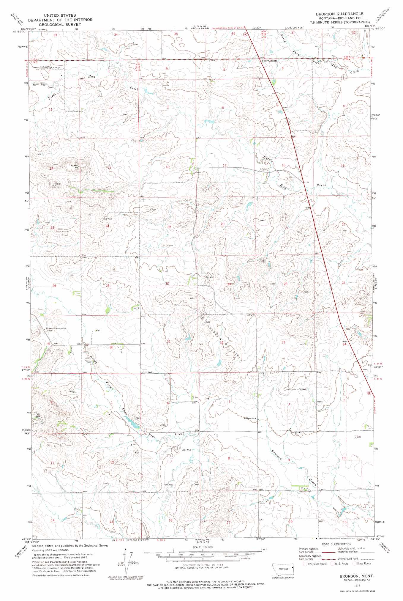
Brorson Topo Map Montana
To zoom in, hover over the map of Brorson
USGS Topo Quad 47104g3 - 1:24,000 scale
| Topo Map Name: | Brorson |
| USGS Topo Quad ID: | 47104g3 |
| Print Size: | ca. 21 1/4" wide x 27" high |
| Southeast Coordinates: | 47.75° N latitude / 104.25° W longitude |
| Map Center Coordinates: | 47.8125° N latitude / 104.3125° W longitude |
| U.S. State: | MT |
| Filename: | o47104g3.jpg |
| Download Map JPG Image: | Brorson topo map 1:24,000 scale |
| Map Type: | Topographic |
| Topo Series: | 7.5´ |
| Map Scale: | 1:24,000 |
| Source of Map Images: | United States Geological Survey (USGS) |
| Alternate Map Versions: |
Brorson MT 1972, updated 1975 Download PDF Buy paper map Brorson MT 2011 Download PDF Buy paper map Brorson MT 2014 Download PDF Buy paper map |
1:24,000 Topo Quads surrounding Brorson
Dugout Creek |
Three Buttes |
Cedar Coulee |
Bainville Sw |
Bainville Se |
Andes |
Blue Hill |
Sioux Pass |
Fairview Nw |
Dore |
Three Buttes Creek East |
Girard |
Brorson |
Fairview Sw |
Fairview |
Lambert |
Crane Nw |
Crane Ne |
Sidney |
Sidney Ne |
Mccone Heights |
Larson School |
Crane |
Piche |
Sidney Se |
> Back to 47104e1 at 1:100,000 scale
> Back to 47104a1 at 1:250,000 scale
> Back to U.S. Topo Maps home
Brorson topo map: Gazetteer
Brorson: Dams
Albin Dam elevation 732m 2401′Coon Dam elevation 706m 2316′
Brorson: Oilfields
Brorson Oil Field elevation 748m 2454′Brorson: Populated Places
Brorson (historical) elevation 703m 2306′Brorson: Post Offices
Brorson Post Office (historical) elevation 703m 2306′Brorson: Streams
Main Hay Creek elevation 703m 2306′Brorson: Wells
23N50E06DBDD01 Well elevation 716m 2349′23N57E11CADA01 Well elevation 733m 2404′
23N57E14ADAD01 Well elevation 702m 2303′
23N58E08BABB01 Well elevation 700m 2296′
23N58E08BABC01 Well elevation 704m 2309′
23N58E34DCCD01 Well elevation 691m 2267′
24N58E08BABA01 Well elevation 710m 2329′
24N58E15ACCB01 Well elevation 686m 2250′
Brorson digital topo map on disk
Buy this Brorson topo map showing relief, roads, GPS coordinates and other geographical features, as a high-resolution digital map file on DVD:
Eastern Montana & Western North Dakota
Buy digital topo maps: Eastern Montana & Western North Dakota