Blue Hill Topo Map Montana
To zoom in, hover over the map of Blue Hill
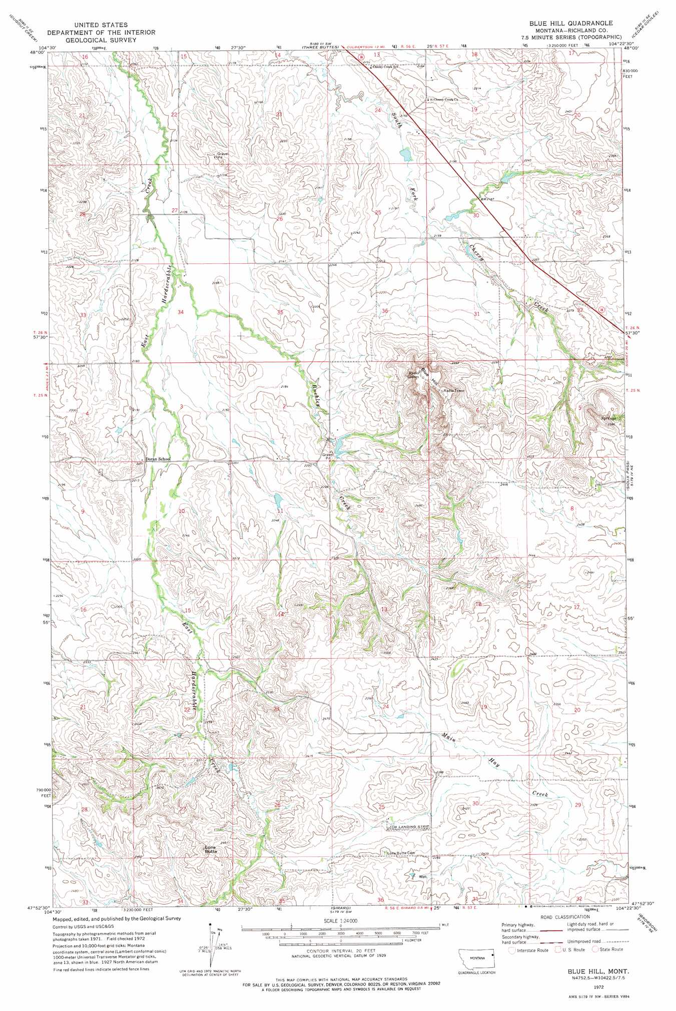
USGS Topo Quad 47104h4 - 1:24,000 scale
| Topo Map Name: | Blue Hill |
| USGS Topo Quad ID: | 47104h4 |
| Print Size: | ca. 21 1/4" wide x 27" high |
| Southeast Coordinates: | 47.875° N latitude / 104.375° W longitude |
| Map Center Coordinates: | 47.9375° N latitude / 104.4375° W longitude |
| U.S. State: | MT |
| Filename: | o47104h4.jpg |
| Download Map JPG Image: | Blue Hill topo map 1:24,000 scale |
| Map Type: | Topographic |
| Topo Series: | 7.5´ |
| Map Scale: | 1:24,000 |
| Source of Map Images: | United States Geological Survey (USGS) |
| Alternate Map Versions: |
Blue Hill MT 1972, updated 1975 Download PDF Buy paper map Blue Hill MT 2011 Download PDF Buy paper map Blue Hill MT 2014 Download PDF Buy paper map |
1:24,000 Topo Quads surrounding Blue Hill
Fort Kipp |
Culbertson |
Mccabe West |
Mccabe East |
Bainville |
Twomile Creek |
Dugout Creek |
Three Buttes |
Cedar Coulee |
Bainville Sw |
Elm Coulee |
Andes |
Blue Hill |
Sioux Pass |
Fairview Nw |
Three Buttes Creek West |
Three Buttes Creek East |
Girard |
Brorson |
Fairview Sw |
Fox Lake |
Lambert |
Crane Nw |
Crane Ne |
Sidney |
> Back to 47104e1 at 1:100,000 scale
> Back to 47104a1 at 1:250,000 scale
> Back to U.S. Topo Maps home
Blue Hill topo map: Gazetteer
Blue Hill: Airports
Wick Landing Strip elevation 712m 2335′Blue Hill: Dams
Arthur Dam elevation 678m 2224′Buckley Dam elevation 668m 2191′
T Hackley Number 1 Dam elevation 646m 2119′
Blue Hill: Post Offices
Nile Post Office (historical) elevation 657m 2155′Blue Hill: Streams
Antelope Creek elevation 652m 2139′Buckley Creek elevation 649m 2129′
Palmers Creek elevation 644m 2112′
Blue Hill: Summits
Blue Hill elevation 801m 2627′Lone Butte elevation 784m 2572′
Blue Hill: Valleys
Cherry Coulee elevation 691m 2267′Blue Hill: Wells
25N56E11BAAB01 Well elevation 692m 2270′25N57E08AAC_01 Well elevation 760m 2493′
25N57E29AAAD01 Well elevation 709m 2326′
26N56E24DACA01 Well elevation 648m 2125′
Blue Hill digital topo map on disk
Buy this Blue Hill topo map showing relief, roads, GPS coordinates and other geographical features, as a high-resolution digital map file on DVD:
Eastern Montana & Western North Dakota
Buy digital topo maps: Eastern Montana & Western North Dakota