Elmdale Nw Topo Map Montana
To zoom in, hover over the map of Elmdale Nw
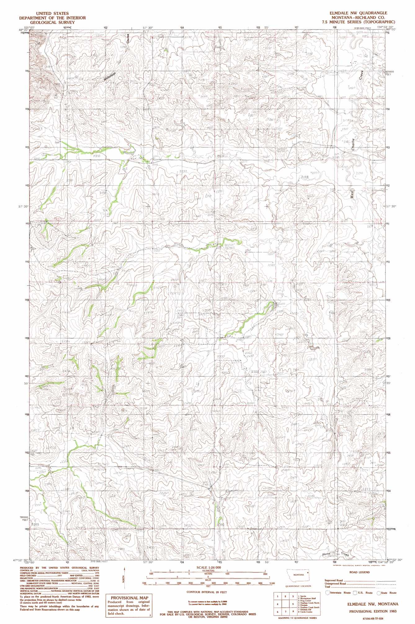
USGS Topo Quad 47104h8 - 1:24,000 scale
| Topo Map Name: | Elmdale Nw |
| USGS Topo Quad ID: | 47104h8 |
| Print Size: | ca. 21 1/4" wide x 27" high |
| Southeast Coordinates: | 47.875° N latitude / 104.875° W longitude |
| Map Center Coordinates: | 47.9375° N latitude / 104.9375° W longitude |
| U.S. State: | MT |
| Filename: | o47104h8.jpg |
| Download Map JPG Image: | Elmdale Nw topo map 1:24,000 scale |
| Map Type: | Topographic |
| Topo Series: | 7.5´ |
| Map Scale: | 1:24,000 |
| Source of Map Images: | United States Geological Survey (USGS) |
| Alternate Map Versions: |
Elmdale NW MT 1983, updated 1983 Download PDF Buy paper map Elmdale NW MT 2011 Download PDF Buy paper map Elmdale NW MT 2014 Download PDF Buy paper map |
1:24,000 Topo Quads surrounding Elmdale Nw
Badger Creek |
Poplar Ne |
Brockton |
Calais |
Fort Kipp |
Poplar |
Sprole |
Mortarstone Bluff |
Frog Coulee |
Twomile Creek |
Sullivan Coulee |
Duplisse Creek North |
Elmdale Nw |
Elmdale |
Elm Coulee |
Lisk Creek |
Duplisse Creek South |
Elmdale Sw |
Carda Coulee |
Three Buttes Creek West |
Richey Nw |
Richey |
Kuester Lake |
Enid |
Fox Lake |
> Back to 47104e1 at 1:100,000 scale
> Back to 47104a1 at 1:250,000 scale
> Back to U.S. Topo Maps home
Elmdale Nw topo map: Gazetteer
Elmdale Nw: Dams
Tolksdorf Number 1 Dam elevation 689m 2260′Tolksdorf Number 2 Dam elevation 694m 2276′
Elmdale Nw: Wells
14N54E29ACCA01 Well elevation 700m 2296′25N52E02BBDA01 Well elevation 731m 2398′
25N52E22CDCA01 Well elevation 701m 2299′
25N52E27BABA01 Well elevation 697m 2286′
25N52E27BABA02 Well elevation 697m 2286′
25N53E07CCAD01 Well elevation 700m 2296′
25N53E16DABC01 Well elevation 687m 2253′
25N53E23CABA01 Well elevation 733m 2404′
25N53E30CCBB01 Well elevation 724m 2375′
25N53E30CCBC01 Well elevation 720m 2362′
25N53E32ADCA01 Well elevation 734m 2408′
26N52E26DDCC01 Well elevation 694m 2276′
26N52E35ABBB01 Well elevation 701m 2299′
26N52E35ABBC01 Well elevation 698m 2290′
Elmdale Nw digital topo map on disk
Buy this Elmdale Nw topo map showing relief, roads, GPS coordinates and other geographical features, as a high-resolution digital map file on DVD:
Eastern Montana & Western North Dakota
Buy digital topo maps: Eastern Montana & Western North Dakota