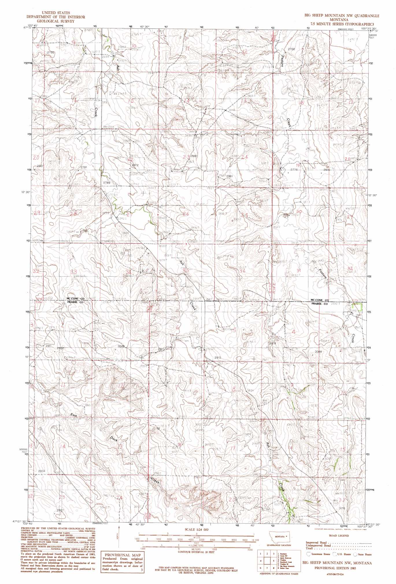
Big Sheep Mountain Nw Topo Map Montana
To zoom in, hover over the map of Big Sheep Mountain Nw
USGS Topo Quad 47105b6 - 1:24,000 scale
| Topo Map Name: | Big Sheep Mountain Nw |
| USGS Topo Quad ID: | 47105b6 |
| Print Size: | ca. 21 1/4" wide x 27" high |
| Southeast Coordinates: | 47.125° N latitude / 105.625° W longitude |
| Map Center Coordinates: | 47.1875° N latitude / 105.6875° W longitude |
| U.S. State: | MT |
| Filename: | o47105b6.jpg |
| Download Map JPG Image: | Big Sheep Mountain Nw topo map 1:24,000 scale |
| Map Type: | Topographic |
| Topo Series: | 7.5´ |
| Map Scale: | 1:24,000 |
| Source of Map Images: | United States Geological Survey (USGS) |
| Alternate Map Versions: |
Big Sheep Mountain NW MT 1983, updated 1983 Download PDF Buy paper map Big Sheep Mountain NW MT 2011 Download PDF Buy paper map Big Sheep Mountain NW MT 2014 Download PDF Buy paper map |
1:24,000 Topo Quads surrounding Big Sheep Mountain Nw
Johnson Coulee East |
Brockway Ne |
Youngquist Mine |
Circle |
Woodworth Hill |
Beauty Creek |
Brockway |
Circle Sw |
Quick Reservoir |
Mount Antelope |
Berry School |
Watkins |
Big Sheep Mountain Nw |
Bearshack Creek |
Diamond G Butte Nw |
Heitz School |
Watkins Se |
Big Sheep Mountain |
Becker Dam |
North Coulee |
Combs Ranch |
Little Sheep Mountain |
South Fork Reservoir |
Mccloud |
Papps Reservoir |
> Back to 47105a1 at 1:100,000 scale
> Back to 47104a1 at 1:250,000 scale
> Back to U.S. Topo Maps home
Big Sheep Mountain Nw topo map: Gazetteer
Big Sheep Mountain Nw: Dams
Tusler Creek Oyargers and Pardies Dam elevation 845m 2772′Big Sheep Mountain Nw: Wells
16N48E09ACC_01 Well elevation 919m 3015′16N48E17ACC_01 Well elevation 913m 2995′
17N47E16DDDD01 Well elevation 837m 2746′
17N48E29BDCB01 Well elevation 874m 2867′
Big Sheep Mountain Nw digital topo map on disk
Buy this Big Sheep Mountain Nw topo map showing relief, roads, GPS coordinates and other geographical features, as a high-resolution digital map file on DVD:
Eastern Montana & Western North Dakota
Buy digital topo maps: Eastern Montana & Western North Dakota