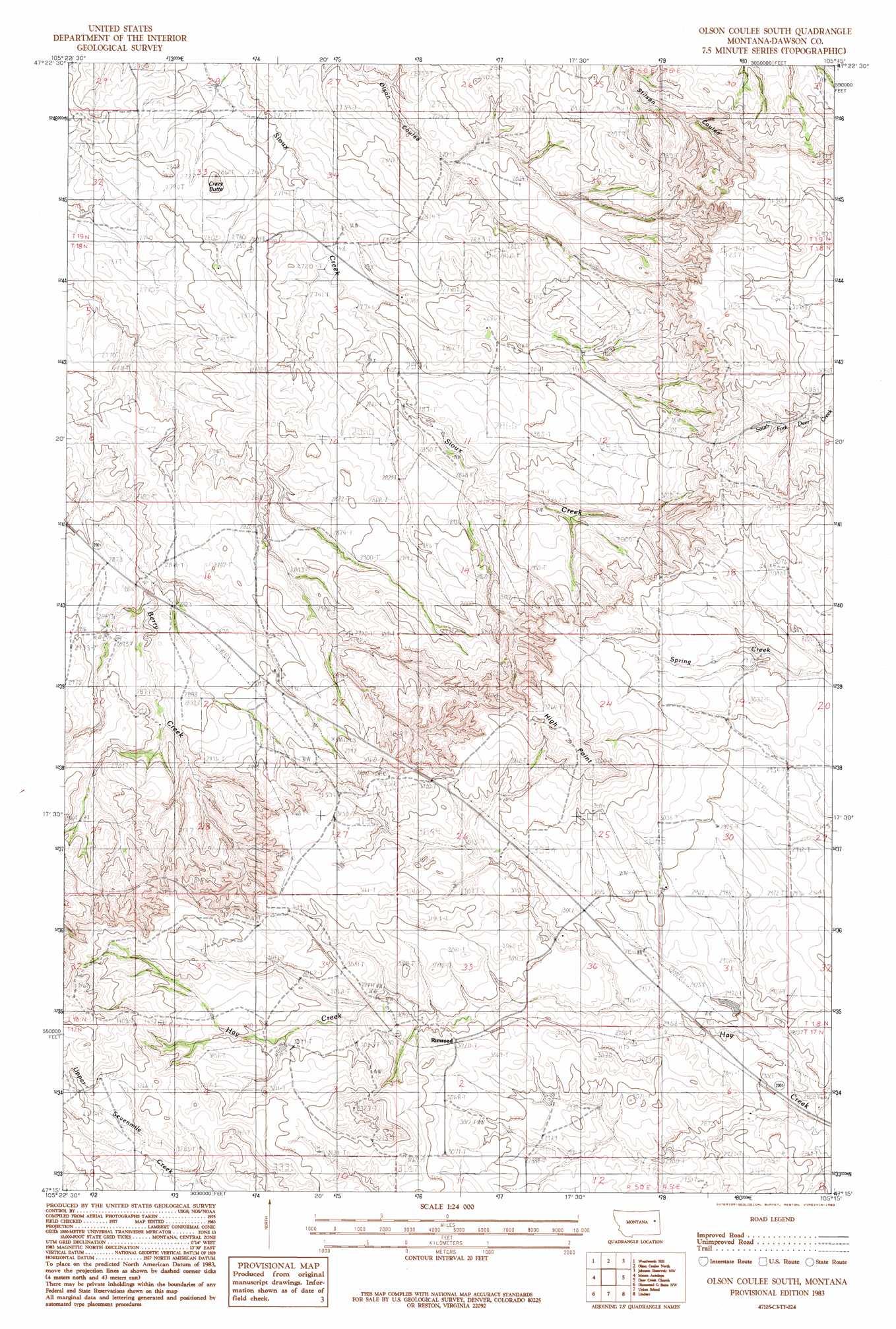
Olson Coulee South Topo Map Montana
To zoom in, hover over the map of Olson Coulee South
USGS Topo Quad 47105c3 - 1:24,000 scale
| Topo Map Name: | Olson Coulee South |
| USGS Topo Quad ID: | 47105c3 |
| Print Size: | ca. 21 1/4" wide x 27" high |
| Southeast Coordinates: | 47.25° N latitude / 105.25° W longitude |
| Map Center Coordinates: | 47.3125° N latitude / 105.3125° W longitude |
| U.S. State: | MT |
| Filename: | o47105c3.jpg |
| Download Map JPG Image: | Olson Coulee South topo map 1:24,000 scale |
| Map Type: | Topographic |
| Topo Series: | 7.5´ |
| Map Scale: | 1:24,000 |
| Source of Map Images: | United States Geological Survey (USGS) |
| Alternate Map Versions: |
Olson Coulee South MT 1983, updated 1983 Download PDF Buy paper map Olson Coulee South MT 2011 Download PDF Buy paper map Olson Coulee South MT 2014 Download PDF Buy paper map |
1:24,000 Topo Quads surrounding Olson Coulee South
Hudiburgh Res. Se |
Buffalo Creek |
Buffalo Creek Se |
Circle Reservoir |
Richey Se |
Circle |
Woodworth Hill |
Olson Coulee North |
Johnson Reservoir Nw |
Johnson Reservoir Ne |
Quick Reservoir |
Mount Antelope |
Olson Coulee South |
Deer Creek Church |
Johnson Reservoir |
Bearshack Creek |
Diamond G Butte Nw |
Union School |
Lindsay |
Woodrow |
Becker Dam |
North Coulee |
Diamond G Butte |
Lindsay Sw |
Upper Cracker Box School |
> Back to 47105a1 at 1:100,000 scale
> Back to 47104a1 at 1:250,000 scale
> Back to U.S. Topo Maps home
Olson Coulee South topo map: Gazetteer
Olson Coulee South: Populated Places
Mink (historical) elevation 970m 3182′Olson Coulee South: Post Offices
Mink Post Office (historical) elevation 970m 3182′Rimroad Post Office (historical) elevation 924m 3031′
Olson Coulee South: Ranges
Big Sheep Mountains elevation 884m 2900′Olson Coulee South: Summits
Crazy Butte elevation 876m 2874′High Point elevation 1016m 3333′
Olson Coulee South: Wells
17N50E05ACD_01 Well elevation 1000m 3280′18N50E04ABD_01 Well elevation 829m 2719′
18N50E16CBB_01 Well elevation 810m 2657′
18N50E16CBBB01 Well elevation 833m 2732′
18N50E25DA__01 Well elevation 937m 3074′
18N50E34DDA_01 Well elevation 914m 2998′
18N50E34DDA_02 Well elevation 914m 2998′
18N51E07BC__01 Well elevation 926m 3038′
19N51E29CCA_01 Well elevation 908m 2979′
Olson Coulee South digital topo map on disk
Buy this Olson Coulee South topo map showing relief, roads, GPS coordinates and other geographical features, as a high-resolution digital map file on DVD:
Eastern Montana & Western North Dakota
Buy digital topo maps: Eastern Montana & Western North Dakota