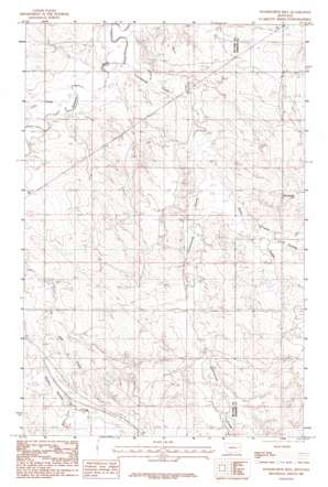
Woodworth Hill Topo Map Montana
To zoom in, hover over the map of Woodworth Hill
USGS Topo Quad 47105d4 - 1:24,000 scale
| Topo Map Name: | Woodworth Hill |
| USGS Topo Quad ID: | 47105d4 |
| Print Size: | ca. 21 1/4" wide x 27" high |
| Southeast Coordinates: | 47.375° N latitude / 105.375° W longitude |
| Map Center Coordinates: | 47.4375° N latitude / 105.4375° W longitude |
| U.S. State: | MT |
| Filename: | o47105d4.jpg |
| Download Map JPG Image: | Woodworth Hill topo map 1:24,000 scale |
| Map Type: | Topographic |
| Topo Series: | 7.5´ |
| Map Scale: | 1:24,000 |
| Source of Map Images: | United States Geological Survey (USGS) |
| Alternate Map Versions: |
Woodworth Hill MT 1983, updated 1983 Download PDF Buy paper map Woodworth Hill MT 2011 Download PDF Buy paper map Woodworth Hill MT 2014 Download PDF Buy paper map |
1:24,000 Topo Quads surrounding Woodworth Hill
> Back to 47105a1 at 1:100,000 scale
> Back to 47104a1 at 1:250,000 scale
> Back to U.S. Topo Maps home
Woodworth Hill topo map: Gazetteer
Woodworth Hill: Dams
James-Smith Dam elevation 775m 2542′Jonas Number 1 Dam elevation 765m 2509′
Snowfall Dam elevation 741m 2431′
Voss Number 1 Dam elevation 812m 2664′
Woodworth Hill: Streams
Cottonwood Creek elevation 709m 2326′Lost Creek elevation 726m 2381′
Sioux Creek elevation 737m 2417′
West Fork Buffalo Springs Creek elevation 789m 2588′
Woodworth Hill: Summits
Woodworth Hill elevation 818m 2683′Woodworth Hill: Valleys
Stilson Coulee elevation 749m 2457′Woodworth Hill: Wells
19N49E01CCCC01 Well elevation 761m 2496′19N49E02DDDC01 Well elevation 766m 2513′
19N49E13CABA01 Well elevation 776m 2545′
19N49E13CACD01 Well elevation 778m 2552′
19N49E13CACD02 Well elevation 778m 2552′
19N49E14AABA01 Well elevation 775m 2542′
19N49E21ACAB01 Well elevation 779m 2555′
19N49E22CBCB01 Well elevation 778m 2552′
19N49E27ABBC01 Well elevation 816m 2677′
19N49E27BABB01 Well elevation 810m 2657′
19N50E17BCD_01 Well elevation 793m 2601′
20N49E17ADDA01 Well elevation 736m 2414′
20N49E24CCDC01 Well elevation 744m 2440′
20N49E26DAAB01 Well elevation 759m 2490′
20N49E26DAAB02 Well elevation 757m 2483′
20N49E27AADC01 Well elevation 750m 2460′
20N49E28DABC01 Well elevation 740m 2427′
20N49E34DDCC01 Well elevation 783m 2568′
20N49E35AADD01 Well elevation 759m 2490′
20N50E18BDCD01 Well elevation 749m 2457′
20N50E18CDDA01 Well elevation 746m 2447′
20N50E19DACB01 Well elevation 769m 2522′
20N50E30AAAB01 Well elevation 768m 2519′
20N50E30AABD01 Well elevation 780m 2559′
Woodworth Hill digital topo map on disk
Buy this Woodworth Hill topo map showing relief, roads, GPS coordinates and other geographical features, as a high-resolution digital map file on DVD:
Eastern Montana & Western North Dakota
Buy digital topo maps: Eastern Montana & Western North Dakota


