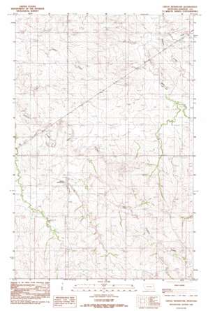
Circle Reservoir Topo Map Montana
To zoom in, hover over the map of Circle Reservoir
USGS Topo Quad 47105e2 - 1:24,000 scale
| Topo Map Name: | Circle Reservoir |
| USGS Topo Quad ID: | 47105e2 |
| Print Size: | ca. 21 1/4" wide x 27" high |
| Southeast Coordinates: | 47.5° N latitude / 105.125° W longitude |
| Map Center Coordinates: | 47.5625° N latitude / 105.1875° W longitude |
| U.S. State: | MT |
| Filename: | o47105e2.jpg |
| Download Map JPG Image: | Circle Reservoir topo map 1:24,000 scale |
| Map Type: | Topographic |
| Topo Series: | 7.5´ |
| Map Scale: | 1:24,000 |
| Source of Map Images: | United States Geological Survey (USGS) |
| Alternate Map Versions: |
Circle Reservoir MT 1983, updated 1983 Download PDF Buy paper map Circle Reservoir MT 2011 Download PDF Buy paper map Circle Reservoir MT 2014 Download PDF Buy paper map |
1:24,000 Topo Quads surrounding Circle Reservoir
> Back to 47105e1 at 1:100,000 scale
> Back to 47104a1 at 1:250,000 scale
> Back to U.S. Topo Maps home
Circle Reservoir topo map: Gazetteer
Circle Reservoir: Dams
Circle Reservoir Dam elevation 773m 2536′Dean S Number 2 Dam elevation 730m 2395′
Circle Reservoir: Reservoirs
Circle Reservoir elevation 773m 2536′Circle Reservoir: Streams
East Fork Pasture Creek elevation 719m 2358′West Fork Pasture Creek elevation 718m 2355′
Circle Reservoir: Wells
21N50E13DCBC01 Well elevation 713m 2339′21N50E36ABBB01 Well elevation 749m 2457′
21N51E10ABBC01 Well elevation 725m 2378′
21N51E10ABCD01 Well elevation 747m 2450′
21N51E14BABD01 Well elevation 739m 2424′
21N51E14BABD02 Well elevation 739m 2424′
21N51E14BABD03 Well elevation 739m 2424′
21N51E14CBBB01 Well elevation 751m 2463′
21N51E18BAAB01 Well elevation 750m 2460′
21N51E19ABBB01 Well elevation 769m 2522′
21N51E19BABC01 Well elevation 731m 2398′
Circle Reservoir digital topo map on disk
Buy this Circle Reservoir topo map showing relief, roads, GPS coordinates and other geographical features, as a high-resolution digital map file on DVD:
Eastern Montana & Western North Dakota
Buy digital topo maps: Eastern Montana & Western North Dakota


