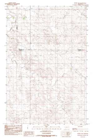
Richey Nw Topo Map Montana
To zoom in, hover over the map of Richey Nw
USGS Topo Quad 47105f2 - 1:24,000 scale
| Topo Map Name: | Richey Nw |
| USGS Topo Quad ID: | 47105f2 |
| Print Size: | ca. 21 1/4" wide x 27" high |
| Southeast Coordinates: | 47.625° N latitude / 105.125° W longitude |
| Map Center Coordinates: | 47.6875° N latitude / 105.1875° W longitude |
| U.S. State: | MT |
| Filename: | o47105f2.jpg |
| Download Map JPG Image: | Richey Nw topo map 1:24,000 scale |
| Map Type: | Topographic |
| Topo Series: | 7.5´ |
| Map Scale: | 1:24,000 |
| Source of Map Images: | United States Geological Survey (USGS) |
| Alternate Map Versions: |
Richey NW MT 1983, updated 1983 Download PDF Buy paper map Richey NW MT 2011 Download PDF Buy paper map Richey NW MT 2014 Download PDF Buy paper map |
1:24,000 Topo Quads surrounding Richey Nw
> Back to 47105e1 at 1:100,000 scale
> Back to 47104a1 at 1:250,000 scale
> Back to U.S. Topo Maps home
Richey Nw topo map: Gazetteer
Richey Nw: Dams
H S Dam elevation 674m 2211′Johnston Dam elevation 717m 2352′
Lee Sa Number 2 Dam elevation 728m 2388′
Othar Number 1 Dam elevation 731m 2398′
Richey Nw: Streams
Pasture Creek elevation 665m 2181′Richey Nw: Wells
22N50E13BADB01 Well elevation 695m 2280′22N50E24BABA01 Well elevation 717m 2352′
22N51E02CBBB01 Well elevation 762m 2500′
22N51E02CBBC01 Well elevation 762m 2500′
22N51E03BAAA01 Well elevation 740m 2427′
22N51E05ADDD01 Well elevation 718m 2355′
22N51E07CCDD01 Well elevation 692m 2270′
22N51E10ADDA01 Well elevation 725m 2378′
22N51E10ADDD01 Well elevation 725m 2378′
22N51E11BCCA01 Well elevation 731m 2398′
22N51E11BCCA02 Well elevation 731m 2398′
22N51E19CBBB01 Well elevation 736m 2414′
22N51E22DBAD01 Well elevation 723m 2372′
22N51E23DDCB01 Well elevation 737m 2417′
22N51E26ABAD01 Well elevation 736m 2414′
22N51E27BAAB01 Well elevation 717m 2352′
22N51E27BABD01 Well elevation 709m 2326′
22N51E28BAAA01 Well elevation 748m 2454′
23N50E24DDCD01 Well elevation 661m 2168′
23N51E14CCCB01 Well elevation 688m 2257′
23N51E14DDAD01 Well elevation 734m 2408′
23N51E20BBBC01 Well elevation 681m 2234′
23N51E20BBBD01 Well elevation 682m 2237′
23N51E22CBAC01 Well elevation 719m 2358′
23N51E22CBDB01 Well elevation 714m 2342′
23N51E23ACAD01 Well elevation 694m 2276′
23N51E26BDBB01 Well elevation 731m 2398′
Richey Nw digital topo map on disk
Buy this Richey Nw topo map showing relief, roads, GPS coordinates and other geographical features, as a high-resolution digital map file on DVD:
Eastern Montana & Western North Dakota
Buy digital topo maps: Eastern Montana & Western North Dakota


