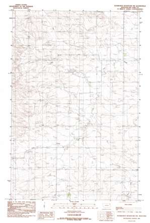
Hudiburgh Res. Topo Map Montana
To zoom in, hover over the map of Hudiburgh Res.
USGS Topo Quad 47105f6 - 1:24,000 scale
| Topo Map Name: | Hudiburgh Res. |
| USGS Topo Quad ID: | 47105f6 |
| Print Size: | ca. 21 1/4" wide x 27" high |
| Southeast Coordinates: | 47.625° N latitude / 105.625° W longitude |
| Map Center Coordinates: | 47.6875° N latitude / 105.6875° W longitude |
| U.S. State: | MT |
| Filename: | o47105f6.jpg |
| Download Map JPG Image: | Hudiburgh Res. topo map 1:24,000 scale |
| Map Type: | Topographic |
| Topo Series: | 7.5´ |
| Map Scale: | 1:24,000 |
| Source of Map Images: | United States Geological Survey (USGS) |
| Alternate Map Versions: |
Hudiburgh Reservoir NW MT 1983, updated 1983 Download PDF Buy paper map Hudiburgh Reservoir NW MT 2011 Download PDF Buy paper map Hudiburgh Reservoir NW MT 2014 Download PDF Buy paper map |
1:24,000 Topo Quads surrounding Hudiburgh Res.
> Back to 47105e1 at 1:100,000 scale
> Back to 47104a1 at 1:250,000 scale
> Back to U.S. Topo Maps home
Hudiburgh Res. topo map: Gazetteer
Hudiburgh Res.: Dams
Howard Dam elevation 775m 2542′Hudiburgh Res.: Populated Places
Hamblin (historical) elevation 784m 2572′Hudiburgh Res.: Post Offices
Cow Creek Post Office (historical) elevation 774m 2539′Hamblin Post Office (historical) elevation 784m 2572′
McCone Post Office (historical) elevation 766m 2513′
Hudiburgh Res.: Springs
Blackjack Spring elevation 770m 2526′Hudiburgh Res.: Wells
22N47E01ACAD01 Well elevation 759m 2490′22N47E03BAAA01 Well elevation 752m 2467′
22N47E14BCCD01 Well elevation 768m 2519′
22N47E19ABBD01 Well elevation 778m 2552′
22N47E21CDCC01 Well elevation 767m 2516′
22N47E21CDCC02 Well elevation 767m 2516′
22N47E22BBBC01 Well elevation 766m 2513′
22N47E23DDBC01 Well elevation 756m 2480′
22N47E26ADAD01 Well elevation 770m 2526′
22N47E26DAAA01 Well elevation 762m 2500′
22N47E28CADD01 Well elevation 774m 2539′
22N47E30BD__01 Well elevation 819m 2687′
22N47E36BACB01 Well elevation 762m 2500′
23N47E21CA__01 Well elevation 782m 2565′
23N47E29DCBB01 Well elevation 784m 2572′
23N47E33ADCD01 Well elevation 758m 2486′
Hudiburgh Res. digital topo map on disk
Buy this Hudiburgh Res. topo map showing relief, roads, GPS coordinates and other geographical features, as a high-resolution digital map file on DVD:
Eastern Montana & Western North Dakota
Buy digital topo maps: Eastern Montana & Western North Dakota


