Vida Topo Map Montana
To zoom in, hover over the map of Vida
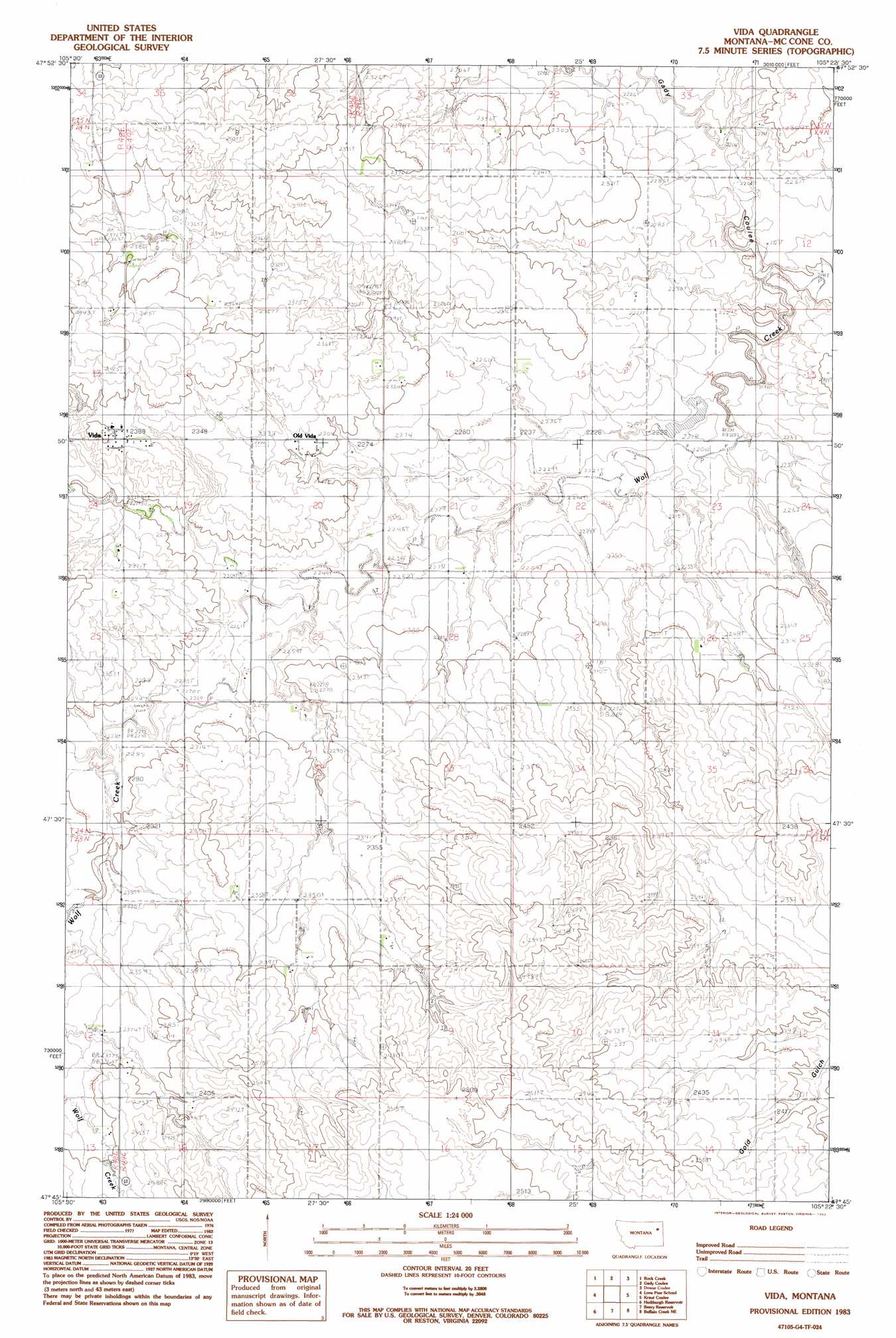
USGS Topo Quad 47105g4 - 1:24,000 scale
| Topo Map Name: | Vida |
| USGS Topo Quad ID: | 47105g4 |
| Print Size: | ca. 21 1/4" wide x 27" high |
| Southeast Coordinates: | 47.75° N latitude / 105.375° W longitude |
| Map Center Coordinates: | 47.8125° N latitude / 105.4375° W longitude |
| U.S. State: | MT |
| Filename: | o47105g4.jpg |
| Download Map JPG Image: | Vida topo map 1:24,000 scale |
| Map Type: | Topographic |
| Topo Series: | 7.5´ |
| Map Scale: | 1:24,000 |
| Source of Map Images: | United States Geological Survey (USGS) |
| Alternate Map Versions: |
Vida MT 1983, updated 1983 Download PDF Buy paper map Vida MT 2011 Download PDF Buy paper map Vida MT 2014 Download PDF Buy paper map |
1:24,000 Topo Quads surrounding Vida
Wolf Point |
Macon |
Chelsea Sw |
Nickwall |
Poplar |
Antelope Creek Res. |
Rock Creek |
Gady Coulee |
Dowse Coulee |
Sullivan Coulee |
Dailey Spring |
Lone Pine School |
Vida |
Kraut Coulee |
Lisk Creek |
Hudiburgh Res. |
Hudiburgh Res. |
Beery Reservoir |
Buffalo Creek Ne |
Richey Nw |
Haynie Reservoir |
Hudiburgh Res. Se |
Buffalo Creek |
Buffalo Creek Se |
Circle Reservoir |
> Back to 47105e1 at 1:100,000 scale
> Back to 47104a1 at 1:250,000 scale
> Back to U.S. Topo Maps home
Vida topo map: Gazetteer
Vida: Dams
Bogar Dam elevation 715m 2345′Vida: Populated Places
Presserville (historical) elevation 729m 2391′Vida elevation 722m 2368′
Vida: Post Offices
Terrace Post Office (historical) elevation 715m 2345′Vida Post Office elevation 731m 2398′
Vida: Streams
Presserville Creek elevation 690m 2263′Watt Creek elevation 686m 2250′
Vida: Valleys
Gady Coulee elevation 659m 2162′Vida: Wells
24N49E20BAAD01 Well elevation 698m 2290′24N49E26CAAA01 Well elevation 700m 2296′
Vida digital topo map on disk
Buy this Vida topo map showing relief, roads, GPS coordinates and other geographical features, as a high-resolution digital map file on DVD:
Eastern Montana & Western North Dakota
Buy digital topo maps: Eastern Montana & Western North Dakota