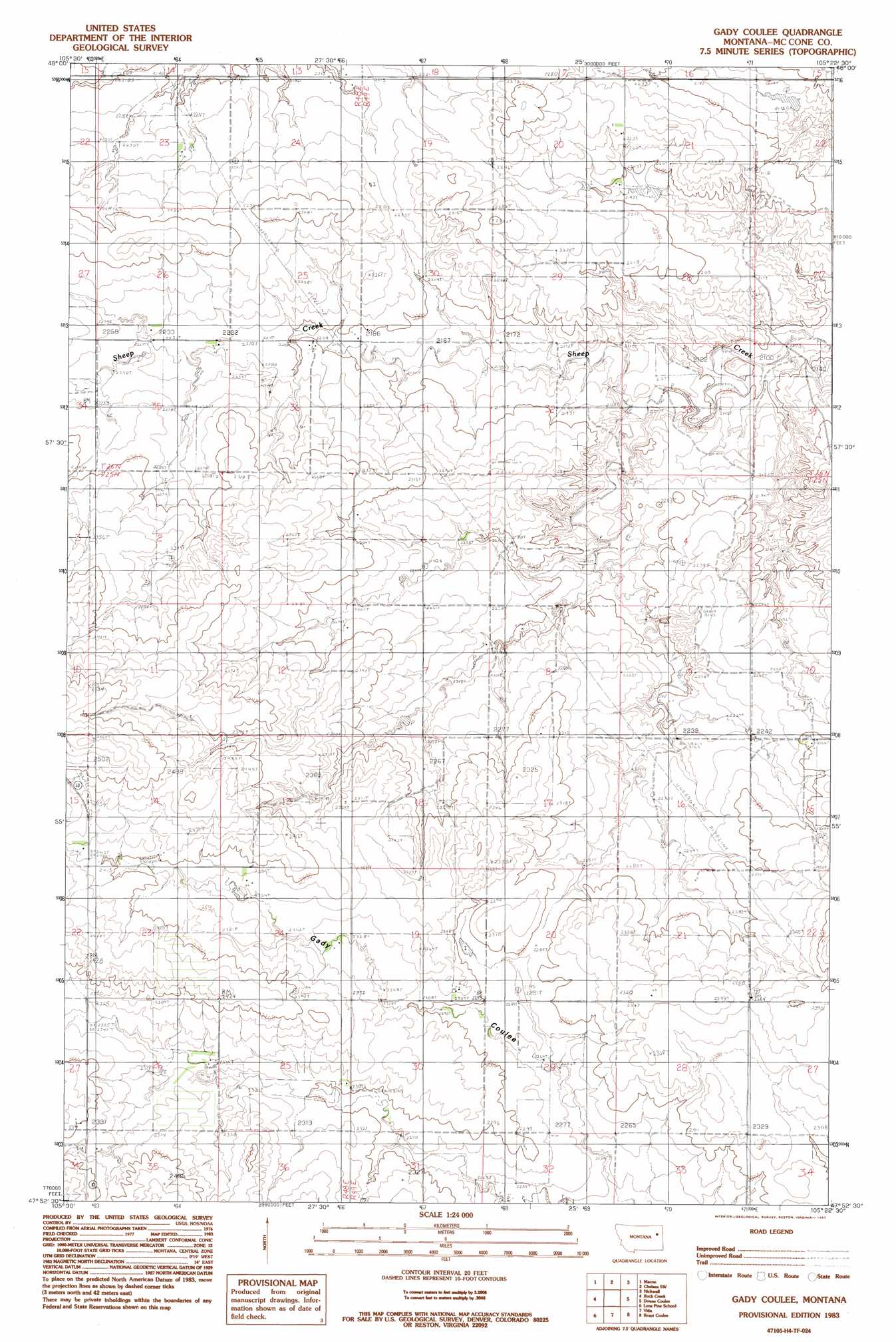
Gady Coulee Topo Map Montana
To zoom in, hover over the map of Gady Coulee
USGS Topo Quad 47105h4 - 1:24,000 scale
| Topo Map Name: | Gady Coulee |
| USGS Topo Quad ID: | 47105h4 |
| Print Size: | ca. 21 1/4" wide x 27" high |
| Southeast Coordinates: | 47.875° N latitude / 105.375° W longitude |
| Map Center Coordinates: | 47.9375° N latitude / 105.4375° W longitude |
| U.S. State: | MT |
| Filename: | o47105h4.jpg |
| Download Map JPG Image: | Gady Coulee topo map 1:24,000 scale |
| Map Type: | Topographic |
| Topo Series: | 7.5´ |
| Map Scale: | 1:24,000 |
| Source of Map Images: | United States Geological Survey (USGS) |
| Alternate Map Versions: |
Gady Coulee MT 1983, updated 1983 Download PDF Buy paper map Gady Coulee MT 2011 Download PDF Buy paper map Gady Coulee MT 2014 Download PDF Buy paper map |
1:24,000 Topo Quads surrounding Gady Coulee
Wolf Point Nw |
Wolf Point Ne |
Chelsea Nw |
Chelsea |
Badger Creek |
Wolf Point |
Macon |
Chelsea Sw |
Nickwall |
Poplar |
Antelope Creek Res. |
Rock Creek |
Gady Coulee |
Dowse Coulee |
Sullivan Coulee |
Dailey Spring |
Lone Pine School |
Vida |
Kraut Coulee |
Lisk Creek |
Hudiburgh Res. |
Hudiburgh Res. |
Beery Reservoir |
Buffalo Creek Ne |
Richey Nw |
> Back to 47105e1 at 1:100,000 scale
> Back to 47104a1 at 1:250,000 scale
> Back to U.S. Topo Maps home
Gady Coulee topo map: Gazetteer
Gady Coulee: Dams
Good Dam elevation 660m 2165′Heslo Dam elevation 710m 2329′
Kniep Kamp Dam elevation 685m 2247′
Gady Coulee: Post Offices
Bogut Post Office (historical) elevation 686m 2250′Burch Post Office (historical) elevation 681m 2234′
Gady Coulee: Wells
25N48E24DAAB01 Well elevation 709m 2326′25N49E15BA__01 Well elevation 695m 2280′
25N49E15BAAA01 Well elevation 704m 2309′
26N49E30AC__01 Well elevation 690m 2263′
Gady Coulee digital topo map on disk
Buy this Gady Coulee topo map showing relief, roads, GPS coordinates and other geographical features, as a high-resolution digital map file on DVD:
Eastern Montana & Western North Dakota
Buy digital topo maps: Eastern Montana & Western North Dakota