Hedstrom Lake Se Topo Map Montana
To zoom in, hover over the map of Hedstrom Lake Se
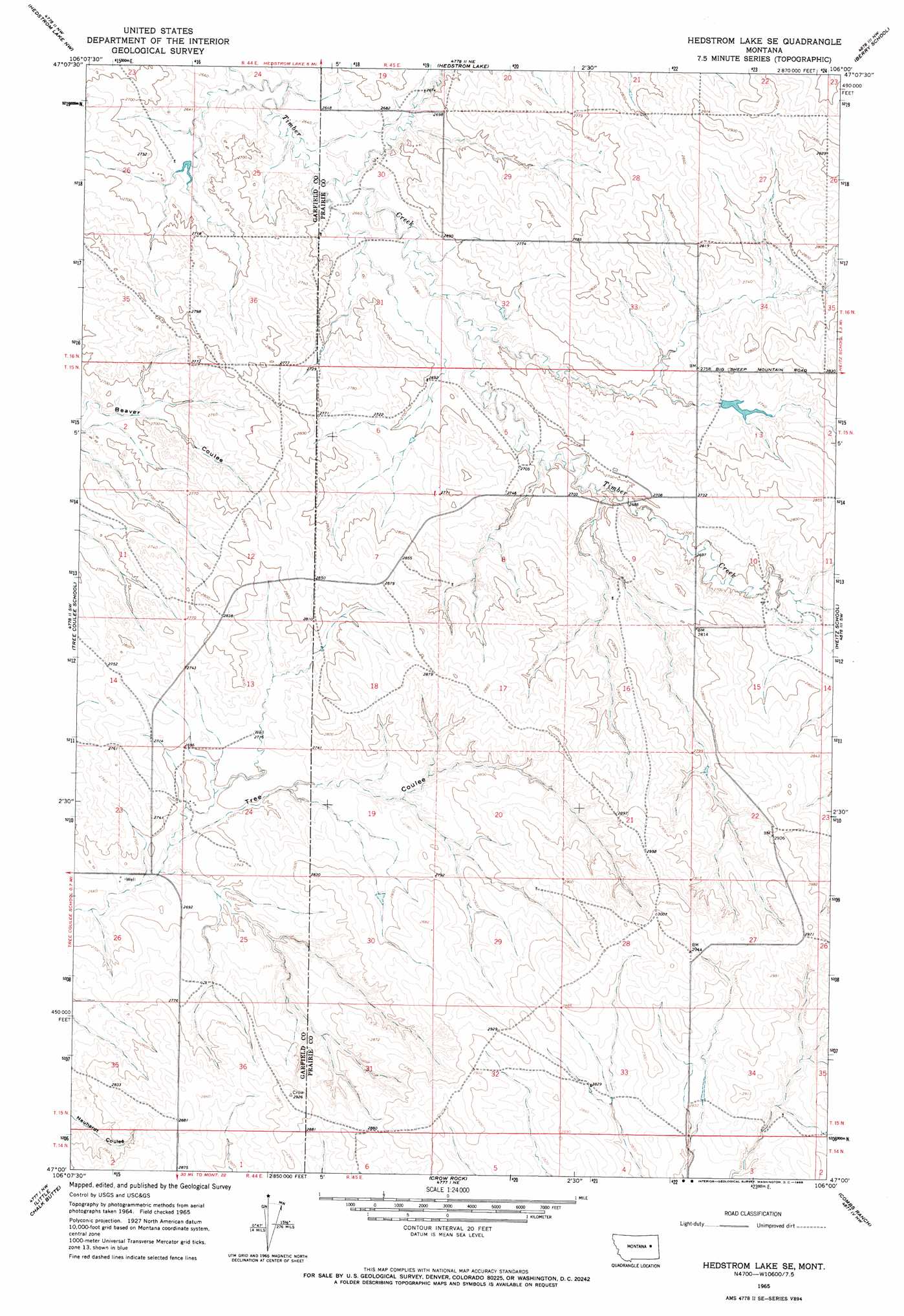
USGS Topo Quad 47106a1 - 1:24,000 scale
| Topo Map Name: | Hedstrom Lake Se |
| USGS Topo Quad ID: | 47106a1 |
| Print Size: | ca. 21 1/4" wide x 27" high |
| Southeast Coordinates: | 47° N latitude / 106° W longitude |
| Map Center Coordinates: | 47.0625° N latitude / 106.0625° W longitude |
| U.S. State: | MT |
| Filename: | o47106a1.jpg |
| Download Map JPG Image: | Hedstrom Lake Se topo map 1:24,000 scale |
| Map Type: | Topographic |
| Topo Series: | 7.5´ |
| Map Scale: | 1:24,000 |
| Source of Map Images: | United States Geological Survey (USGS) |
| Alternate Map Versions: |
Hedstrom Lake SE MT 1965, updated 1968 Download PDF Buy paper map Hedstrom Lake SE MT 2011 Download PDF Buy paper map Hedstrom Lake SE MT 2014 Download PDF Buy paper map |
1:24,000 Topo Quads surrounding Hedstrom Lake Se
Coal Creek |
Flowing Well |
Cemetery Coulee |
Beauty Creek |
Brockway |
Whiteside Ranch |
Hedstrom Lake Nw |
Hedstrom Lake |
Berry School |
Watkins |
Sleepy Hollow |
Tree Coulee School |
Hedstrom Lake Se |
Heitz School |
Watkins Se |
Coleman Coulee |
Little Chalk Butte |
Crow Rock |
Combs Ranch |
Little Sheep Mountain |
Red Buttes |
Rock Springs School |
Crow Rock Se |
Twin Buttes School |
Morehouse Creek |
> Back to 47106a1 at 1:100,000 scale
> Back to 47106a1 at 1:250,000 scale
> Back to U.S. Topo Maps home
Hedstrom Lake Se topo map: Gazetteer
Hedstrom Lake Se: Dams
Swift Dam elevation 841m 2759′Hedstrom Lake Se: Post Offices
Graber Post Office (historical) elevation 872m 2860′Hedstrom Lake Se: Streams
Chalk Butte Creek elevation 829m 2719′Slinker Creek elevation 809m 2654′
Hedstrom Lake Se: Wells
15N44E11DDBD01 Well elevation 840m 2755′15N44E24BCBC01 Well elevation 826m 2709′
15N44E25CCAD01 Well elevation 839m 2752′
15N45E04CBCC01 Well elevation 814m 2670′
15N45E06AAAC01 Well elevation 823m 2700′
15N45E09CDBA01 Well elevation 834m 2736′
15N45E29AABC01 Well elevation 866m 2841′
15N45E33CBAD01 Well elevation 866m 2841′
16N44E25ABBD01 Well elevation 804m 2637′
16N44E25BBAA01 Well elevation 809m 2654′
16N44E25BBAB01 Well elevation 807m 2647′
16N44E25BBAC01 Well elevation 812m 2664′
16N45E29CDDB01 Well elevation 840m 2755′
Hedstrom Lake Se digital topo map on disk
Buy this Hedstrom Lake Se topo map showing relief, roads, GPS coordinates and other geographical features, as a high-resolution digital map file on DVD:
Eastern Montana & Western North Dakota
Buy digital topo maps: Eastern Montana & Western North Dakota