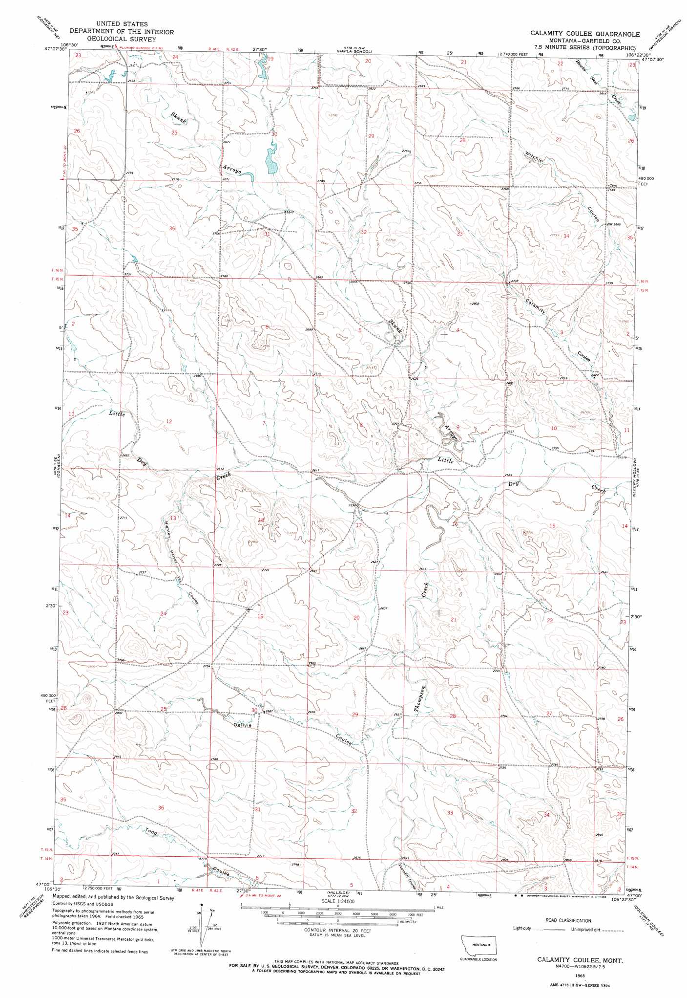
Calamity Coulee Topo Map Montana
To zoom in, hover over the map of Calamity Coulee
USGS Topo Quad 47106a4 - 1:24,000 scale
| Topo Map Name: | Calamity Coulee |
| USGS Topo Quad ID: | 47106a4 |
| Print Size: | ca. 21 1/4" wide x 27" high |
| Southeast Coordinates: | 47° N latitude / 106.375° W longitude |
| Map Center Coordinates: | 47.0625° N latitude / 106.4375° W longitude |
| U.S. State: | MT |
| Filename: | o47106a4.jpg |
| Download Map JPG Image: | Calamity Coulee topo map 1:24,000 scale |
| Map Type: | Topographic |
| Topo Series: | 7.5´ |
| Map Scale: | 1:24,000 |
| Source of Map Images: | United States Geological Survey (USGS) |
| Alternate Map Versions: |
Calamity Coulee MT 1965, updated 1968 Download PDF Buy paper map Calamity Coulee MT 2011 Download PDF Buy paper map Calamity Coulee MT 2014 Download PDF Buy paper map |
1:24,000 Topo Quads surrounding Calamity Coulee
Black John Coulee |
Ada Creek |
Maxwell Coulee |
Coal Creek |
Flowing Well |
York Reservoir |
Cohagen Ne |
Hafla School |
Whiteside Ranch |
Hedstrom Lake Nw |
Cohagen Sw |
Cohagen |
Calamity Coulee |
Sleepy Hollow |
Tree Coulee School |
Black Hills |
Christenson Reservoir |
Hillside |
Coleman Coulee |
Little Chalk Butte |
Needle Butte Reservoir |
Needle Butte |
Clear Water Reservoir |
Red Buttes |
Rock Springs School |
> Back to 47106a1 at 1:100,000 scale
> Back to 47106a1 at 1:250,000 scale
> Back to U.S. Topo Maps home
Calamity Coulee topo map: Gazetteer
Calamity Coulee: Dams
William Pluhar Dam elevation 815m 2673′Calamity Coulee: Populated Places
Allen (historical) elevation 803m 2634′Calamity Coulee: Post Offices
Allen Post Office (historical) elevation 803m 2634′Calamity Coulee: Streams
Skunk Arroyo elevation 786m 2578′Thompson Creek elevation 784m 2572′
Calamity Coulee: Valleys
Calamity Coulee elevation 789m 2588′Flannery Coulee elevation 808m 2650′
Nighten Helser Coulee elevation 797m 2614′
Ogilvie Coulee elevation 800m 2624′
Calamity Coulee: Wells
15N42E04CCDB01 Well elevation 797m 2614′16N42E34CCCC01 Well elevation 823m 2700′
Calamity Coulee digital topo map on disk
Buy this Calamity Coulee topo map showing relief, roads, GPS coordinates and other geographical features, as a high-resolution digital map file on DVD:
Eastern Montana & Western North Dakota
Buy digital topo maps: Eastern Montana & Western North Dakota