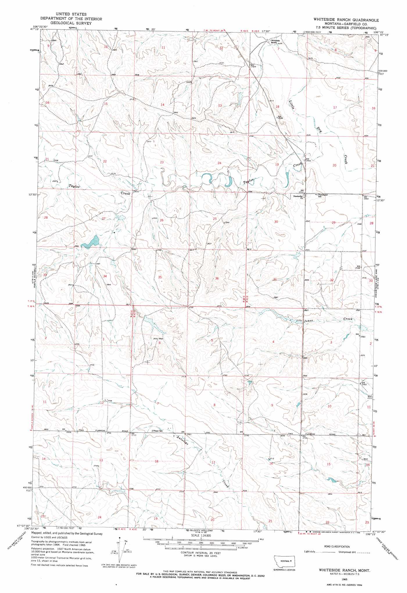
Whiteside Ranch Topo Map Montana
To zoom in, hover over the map of Whiteside Ranch
USGS Topo Quad 47106b3 - 1:24,000 scale
| Topo Map Name: | Whiteside Ranch |
| USGS Topo Quad ID: | 47106b3 |
| Print Size: | ca. 21 1/4" wide x 27" high |
| Southeast Coordinates: | 47.125° N latitude / 106.25° W longitude |
| Map Center Coordinates: | 47.1875° N latitude / 106.3125° W longitude |
| U.S. State: | MT |
| Filename: | o47106b3.jpg |
| Download Map JPG Image: | Whiteside Ranch topo map 1:24,000 scale |
| Map Type: | Topographic |
| Topo Series: | 7.5´ |
| Map Scale: | 1:24,000 |
| Source of Map Images: | United States Geological Survey (USGS) |
| Alternate Map Versions: |
Whiteside Ranch MT 1965, updated 1968 Download PDF Buy paper map Whiteside Ranch MT 2011 Download PDF Buy paper map Whiteside Ranch MT 2014 Download PDF Buy paper map |
1:24,000 Topo Quads surrounding Whiteside Ranch
Bateman Coulee Ne |
Hagen Gap |
Frank Coulee |
Fortyfour Coulee |
Johnson Coulee West |
Ada Creek |
Maxwell Coulee |
Coal Creek |
Flowing Well |
Cemetery Coulee |
Cohagen Ne |
Hafla School |
Whiteside Ranch |
Hedstrom Lake Nw |
Hedstrom Lake |
Cohagen |
Calamity Coulee |
Sleepy Hollow |
Tree Coulee School |
Hedstrom Lake Se |
Christenson Reservoir |
Hillside |
Coleman Coulee |
Little Chalk Butte |
Crow Rock |
> Back to 47106a1 at 1:100,000 scale
> Back to 47106a1 at 1:250,000 scale
> Back to U.S. Topo Maps home
Whiteside Ranch topo map: Gazetteer
Whiteside Ranch: Dams
Bank Dam elevation 781m 2562′Garhart Dam elevation 781m 2562′
Ol John Dam elevation 808m 2650′
Steffins Number 1 Dam elevation 814m 2670′
Whiteside Ranch: Streams
Taylor Creek elevation 758m 2486′Whiteside Ranch: Wells
17N43E07B___01 Well elevation 747m 2450′Whiteside Ranch digital topo map on disk
Buy this Whiteside Ranch topo map showing relief, roads, GPS coordinates and other geographical features, as a high-resolution digital map file on DVD:
Eastern Montana & Western North Dakota
Buy digital topo maps: Eastern Montana & Western North Dakota