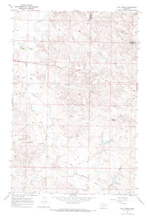
Coal Creek Topo Map Montana
To zoom in, hover over the map of Coal Creek
USGS Topo Quad 47106c3 - 1:24,000 scale
| Topo Map Name: | Coal Creek |
| USGS Topo Quad ID: | 47106c3 |
| Print Size: | ca. 21 1/4" wide x 27" high |
| Southeast Coordinates: | 47.25° N latitude / 106.25° W longitude |
| Map Center Coordinates: | 47.3125° N latitude / 106.3125° W longitude |
| U.S. State: | MT |
| Filename: | o47106c3.jpg |
| Download Map JPG Image: | Coal Creek topo map 1:24,000 scale |
| Map Type: | Topographic |
| Topo Series: | 7.5´ |
| Map Scale: | 1:24,000 |
| Source of Map Images: | United States Geological Survey (USGS) |
| Alternate Map Versions: |
Coal Creek MT 1967, updated 1970 Download PDF Buy paper map Coal Creek MT 2011 Download PDF Buy paper map Coal Creek MT 2014 Download PDF Buy paper map |
1:24,000 Topo Quads surrounding Coal Creek
> Back to 47106a1 at 1:100,000 scale
> Back to 47106a1 at 1:250,000 scale
> Back to U.S. Topo Maps home
Coal Creek topo map: Gazetteer
Coal Creek: Dams
Frady Number 1 Dam elevation 767m 2516′Jeffrey Number 1 Dam elevation 723m 2372′
Jeffrey Number 2 Dam elevation 760m 2493′
Stevens Coulee Number 1 Dam elevation 760m 2493′
Coal Creek: Streams
Big Wild Horse Creek elevation 716m 2349′Coal Creek elevation 710m 2329′
Gibbs Creek elevation 733m 2404′
Little Dry Creek elevation 709m 2326′
Little Wild Horse Creek elevation 725m 2378′
North Prong Coal Creek elevation 719m 2358′
Spring Creek elevation 732m 2401′
Coal Creek: Summits
Hook Rock elevation 809m 2654′White Buttes elevation 817m 2680′
Coal Creek: Valleys
Bridge Coulee elevation 718m 2355′Calamity Coulee elevation 728m 2388′
Norwegian Coulee elevation 726m 2381′
Steves Coulee elevation 735m 2411′
Wilkinson Coulee elevation 716m 2349′
Coal Creek: Wells
17N42E01D___01 Well elevation 739m 2424′17N42E04DCCC01 Well elevation 772m 2532′
18N43E06BB__01 Well elevation 770m 2526′
18N43E17B___01 Well elevation 794m 2604′
18N43E28CBDB01 Well elevation 793m 2601′
18N43E29AA__01 Well elevation 789m 2588′
19N42E25DA__01 Well elevation 782m 2565′
Coal Creek digital topo map on disk
Buy this Coal Creek topo map showing relief, roads, GPS coordinates and other geographical features, as a high-resolution digital map file on DVD:
Eastern Montana & Western North Dakota
Buy digital topo maps: Eastern Montana & Western North Dakota


