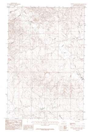
Johnson Coulee West Topo Map Montana
To zoom in, hover over the map of Johnson Coulee West
USGS Topo Quad 47106d1 - 1:24,000 scale
| Topo Map Name: | Johnson Coulee West |
| USGS Topo Quad ID: | 47106d1 |
| Print Size: | ca. 21 1/4" wide x 27" high |
| Southeast Coordinates: | 47.375° N latitude / 106° W longitude |
| Map Center Coordinates: | 47.4375° N latitude / 106.0625° W longitude |
| U.S. State: | MT |
| Filename: | o47106d1.jpg |
| Download Map JPG Image: | Johnson Coulee West topo map 1:24,000 scale |
| Map Type: | Topographic |
| Topo Series: | 7.5´ |
| Map Scale: | 1:24,000 |
| Source of Map Images: | United States Geological Survey (USGS) |
| Alternate Map Versions: |
Johnson Coulee West MT 1983, updated 1983 Download PDF Buy paper map Johnson Coulee West MT 2011 Download PDF Buy paper map Johnson Coulee West MT 2014 Download PDF Buy paper map |
1:24,000 Topo Quads surrounding Johnson Coulee West
> Back to 47106a1 at 1:100,000 scale
> Back to 47106a1 at 1:250,000 scale
> Back to U.S. Topo Maps home
Johnson Coulee West topo map: Gazetteer
Johnson Coulee West: Dams
Dreyer Brothers Incorporated Number 1 Dam elevation 761m 2496′Hannaland Number 1 Dam elevation 785m 2575′
Murphy Number 2 Dam elevation 783m 2568′
Johnson Coulee West: Streams
South Fork Nelson Creek elevation 757m 2483′Johnson Coulee West: Valleys
Crookers Coulee elevation 736m 2414′Dogtown Coulee elevation 726m 2381′
Garfield Coulee elevation 761m 2496′
Johnson Coulee elevation 752m 2467′
Morris Coulee elevation 727m 2385′
Johnson Coulee West: Wells
19N44E01ADCD01 Well elevation 782m 2565′19N44E09CBAA01 Well elevation 807m 2647′
19N45E06CCCD01 Well elevation 777m 2549′
20N44E24BDAC01 Well elevation 776m 2545′
20N44E27CBDA01 Well elevation 789m 2588′
20N45E17CCBB01 Well elevation 822m 2696′
20N45E19DDDD01 Well elevation 786m 2578′
20N45E20DDBC01 Well elevation 779m 2555′
20N45E30DBAB01 Well elevation 763m 2503′
Johnson Coulee West digital topo map on disk
Buy this Johnson Coulee West topo map showing relief, roads, GPS coordinates and other geographical features, as a high-resolution digital map file on DVD:
Eastern Montana & Western North Dakota
Buy digital topo maps: Eastern Montana & Western North Dakota


