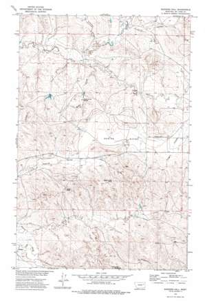
Rodgers Hall Topo Map Montana
To zoom in, hover over the map of Rodgers Hall
USGS Topo Quad 47106e1 - 1:24,000 scale
| Topo Map Name: | Rodgers Hall |
| USGS Topo Quad ID: | 47106e1 |
| Print Size: | ca. 21 1/4" wide x 27" high |
| Southeast Coordinates: | 47.5° N latitude / 106° W longitude |
| Map Center Coordinates: | 47.5625° N latitude / 106.0625° W longitude |
| U.S. State: | MT |
| Filename: | o47106e1.jpg |
| Download Map JPG Image: | Rodgers Hall topo map 1:24,000 scale |
| Map Type: | Topographic |
| Topo Series: | 7.5´ |
| Map Scale: | 1:24,000 |
| Source of Map Images: | United States Geological Survey (USGS) |
| Alternate Map Versions: |
Rodgers Hall MT 1973, updated 1977 Download PDF Buy paper map Rodgers Hall MT 2011 Download PDF Buy paper map Rodgers Hall MT 2014 Download PDF Buy paper map |
1:24,000 Topo Quads surrounding Rodgers Hall
> Back to 47106e1 at 1:100,000 scale
> Back to 47106a1 at 1:250,000 scale
> Back to U.S. Topo Maps home
Rodgers Hall topo map: Gazetteer
Rodgers Hall: Basins
Romine Divide elevation 751m 2463′Rodgers Hall: Dams
Paine Dam elevation 753m 2470′Towe Farms Number 3 Dam elevation 732m 2401′
Rodgers Hall: Pillars
Eagle Rock elevation 809m 2654′Rodgers Hall: Populated Places
Coal Creek (historical) elevation 770m 2526′Rodgers Hall: Springs
School Section Springs elevation 750m 2460′Rodgers Hall: Streams
Coal Creek elevation 714m 2342′North Fork McGuire Creek elevation 718m 2355′
Rodgers Hall: Summits
Devils Table Rock elevation 838m 2749′McDonald Butte elevation 847m 2778′
Rodgers Hall: Valleys
Anderson Coulee elevation 726m 2381′Badgley Coulee elevation 717m 2352′
Kurth Coulee elevation 725m 2378′
Kvam Coulee elevation 713m 2339′
Porcupine Coulee elevation 737m 2417′
Rodgers Coulee elevation 744m 2440′
Rodgers Hall: Wells
20N45E05DDB_01 Well elevation 830m 2723′20N45E08DDAC01 Well elevation 836m 2742′
21N44E04DCCB01 Well elevation 721m 2365′
21N44E11CDAC01 Well elevation 741m 2431′
21N44E11DCDA01 Well elevation 738m 2421′
21N44E16DBCD01 Well elevation 783m 2568′
21N44E23BBDC01 Well elevation 756m 2480′
21N44E23CBCD01 Well elevation 763m 2503′
21N44E24BDCC01 Well elevation 773m 2536′
21N44E28DBCC01 Well elevation 766m 2513′
21N44E28DCB_01 Well elevation 771m 2529′
21N45E07BCDD01 Well elevation 765m 2509′
22N44E23DDBC01 Well elevation 762m 2500′
22N44E35BAAA01 Well elevation 818m 2683′
22N44E35BACB01 Well elevation 804m 2637′
22N44E35BACB02 Well elevation 804m 2637′
22N44E36CBBB01 Well elevation 811m 2660′
Rodgers Hall digital topo map on disk
Buy this Rodgers Hall topo map showing relief, roads, GPS coordinates and other geographical features, as a high-resolution digital map file on DVD:
Eastern Montana & Western North Dakota
Buy digital topo maps: Eastern Montana & Western North Dakota


