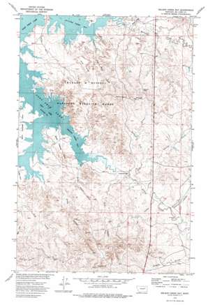
Nelson Creek Bay Topo Map Montana
To zoom in, hover over the map of Nelson Creek Bay
USGS Topo Quad 47106e2 - 1:24,000 scale
| Topo Map Name: | Nelson Creek Bay |
| USGS Topo Quad ID: | 47106e2 |
| Print Size: | ca. 21 1/4" wide x 27" high |
| Southeast Coordinates: | 47.5° N latitude / 106.125° W longitude |
| Map Center Coordinates: | 47.5625° N latitude / 106.1875° W longitude |
| U.S. State: | MT |
| Filename: | o47106e2.jpg |
| Download Map JPG Image: | Nelson Creek Bay topo map 1:24,000 scale |
| Map Type: | Topographic |
| Topo Series: | 7.5´ |
| Map Scale: | 1:24,000 |
| Source of Map Images: | United States Geological Survey (USGS) |
| Alternate Map Versions: |
Nelson Creek Bay MT 1973, updated 1977 Download PDF Buy paper map Nelson Creek Bay MT 2011 Download PDF Buy paper map Nelson Creek Bay MT 2014 Download PDF Buy paper map |
1:24,000 Topo Quads surrounding Nelson Creek Bay
> Back to 47106e1 at 1:100,000 scale
> Back to 47106a1 at 1:250,000 scale
> Back to U.S. Topo Maps home
Nelson Creek Bay topo map: Gazetteer
Nelson Creek Bay: Bays
McGuire Creek Bay elevation 686m 2250′Nelson Creek Bay elevation 686m 2250′
Nelson Creek Bay: Capes
Jacks Point elevation 707m 2319′North Twitchell Point elevation 700m 2296′
South Twitchell Point elevation 716m 2349′
Nelson Creek Bay: Dams
R C Mothershead Number 1 Dam elevation 767m 2516′Nelson Creek Bay: Parks
McGuire Creek Recreation Area elevation 710m 2329′Nelson Creek Recreation Area elevation 698m 2290′
Nelson Creek Bay: Ridges
Jacks Ridge elevation 750m 2460′Racetrack Ridge elevation 764m 2506′
Nelson Creek Bay: Springs
Carney Springs elevation 696m 2283′Nelson Creek Bay: Streams
McGuire Creek elevation 686m 2250′Nelson Creek elevation 686m 2250′
Rough Prong McGuire Creek elevation 691m 2267′
Nelson Creek Bay: Valleys
Coal Bank Coulee elevation 686m 2250′Deer Coulee elevation 696m 2283′
Jim Coulee elevation 699m 2293′
North Fork Jim Coulee elevation 711m 2332′
Pine Coulee elevation 705m 2312′
Romine Coulee elevation 703m 2306′
South Foster Coulee elevation 690m 2263′
Steer Coulee elevation 686m 2250′
Nelson Creek Bay: Wells
01N45E29BBCC01 Well elevation 749m 2457′01N45E31BCBA01 Well elevation 805m 2641′
20N43E01AABD01 Well elevation 746m 2447′
21N43E36BCCD01 Well elevation 703m 2306′
21N43E36DAAC01 Well elevation 707m 2319′
21N43E36DAAD01 Well elevation 713m 2339′
Nelson Creek Bay digital topo map on disk
Buy this Nelson Creek Bay topo map showing relief, roads, GPS coordinates and other geographical features, as a high-resolution digital map file on DVD:
Eastern Montana & Western North Dakota
Buy digital topo maps: Eastern Montana & Western North Dakota


