Bobcat Creek Topo Map Montana
To zoom in, hover over the map of Bobcat Creek
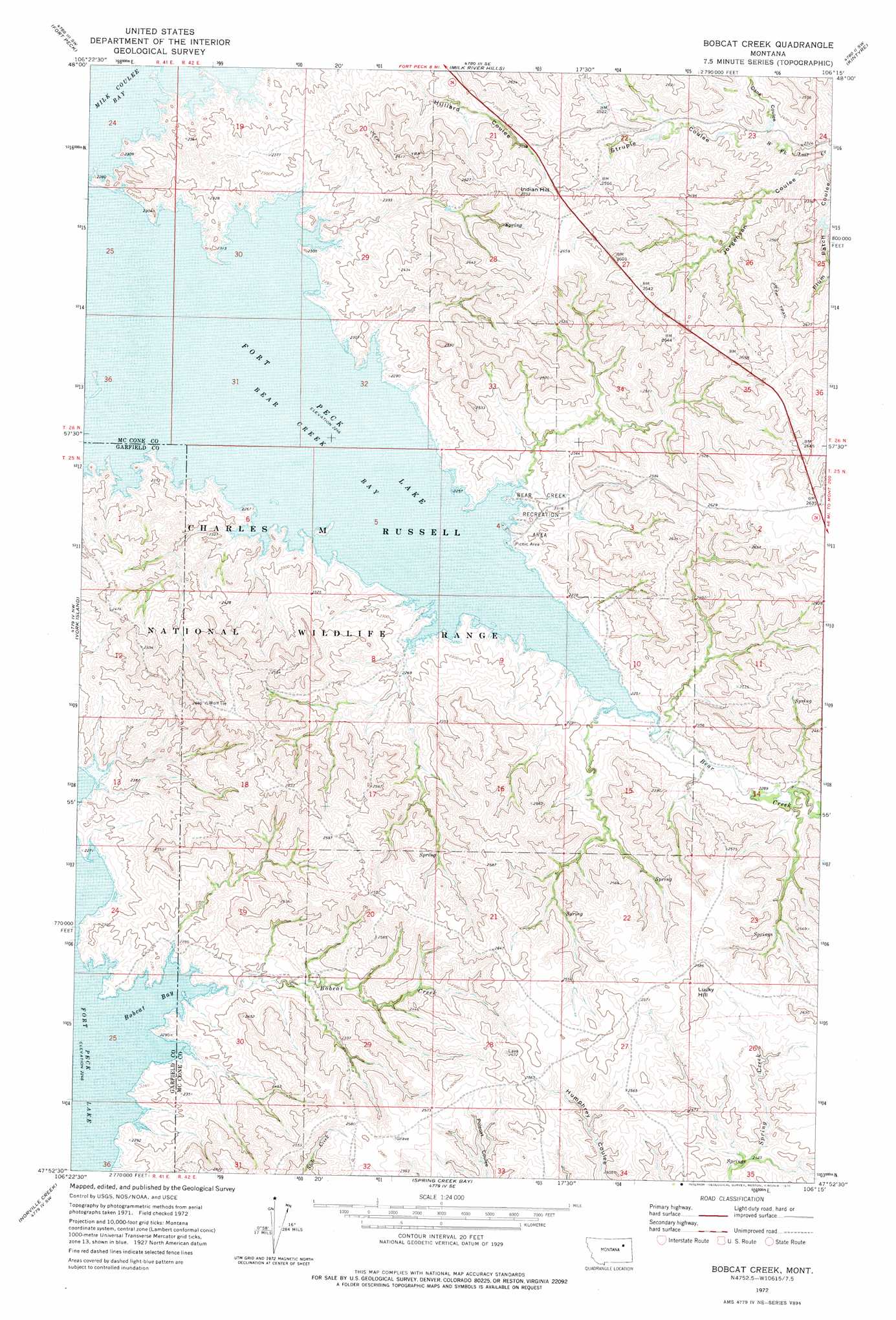
USGS Topo Quad 47106h3 - 1:24,000 scale
| Topo Map Name: | Bobcat Creek |
| USGS Topo Quad ID: | 47106h3 |
| Print Size: | ca. 21 1/4" wide x 27" high |
| Southeast Coordinates: | 47.875° N latitude / 106.25° W longitude |
| Map Center Coordinates: | 47.9375° N latitude / 106.3125° W longitude |
| U.S. State: | MT |
| Filename: | o47106h3.jpg |
| Download Map JPG Image: | Bobcat Creek topo map 1:24,000 scale |
| Map Type: | Topographic |
| Topo Series: | 7.5´ |
| Map Scale: | 1:24,000 |
| Source of Map Images: | United States Geological Survey (USGS) |
| Alternate Map Versions: |
Bobcat Creek MT 1972, updated 1976 Download PDF Buy paper map Bobcat Creek MT 2011 Download PDF Buy paper map Bobcat Creek MT 2014 Download PDF Buy paper map |
1:24,000 Topo Quads surrounding Bobcat Creek
Whately |
Lindeke Coulee |
Nashua |
Milk River Coulee |
Dubbe Reservoir |
Wheeler |
Fort Peck |
Milk River Hills |
Kintyre |
Frazer |
Skunk Coulee |
York Island |
Bobcat Creek |
Mcrae Springs |
Pasture Creek |
Sage Creek Point |
Norville Creek |
Spring Creek Bay |
Sand Arroyo |
Willis Buttes |
Gilbert Creek |
Ash Creek West |
Ash Creek East |
Bug Creek |
Crow Springs |
> Back to 47106e1 at 1:100,000 scale
> Back to 47106a1 at 1:250,000 scale
> Back to U.S. Topo Maps home
Bobcat Creek topo map: Gazetteer
Bobcat Creek: Bays
Bear Creek Bay elevation 685m 2247′Bobcat Bay elevation 685m 2247′
Bobcat Creek: Parks
Bear Creek Recreation Area elevation 693m 2273′Bobcat Creek: Streams
Bear Creek elevation 686m 2250′Bobcat Creek elevation 688m 2257′
Bobcat Creek: Summits
Indian Hill elevation 831m 2726′Lucky Hill elevation 807m 2647′
Bobcat Creek: Valleys
Dane Coulee elevation 717m 2352′Jorgensen Coulee elevation 694m 2276′
Plum Patch Coulee elevation 696m 2283′
Struple Coulee elevation 718m 2355′
Bobcat Creek digital topo map on disk
Buy this Bobcat Creek topo map showing relief, roads, GPS coordinates and other geographical features, as a high-resolution digital map file on DVD:
Eastern Montana & Western North Dakota
Buy digital topo maps: Eastern Montana & Western North Dakota